Category:Maps of Ismenius Lacus quadrangle
Subcategories
This category has only the following subcategory.
Media in category "Maps of Ismenius Lacus quadrangle"
The following 15 files are in this category, out of 15 total.
-
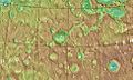
 Arabia Terra Craters (PIA25938).png 201 × 335; 168 KB
-
 FocasMartianCraterLOC.jpg 972 × 580; 151 KB
-
 Topographic view of Ismenia Patera ESA392374.tiff 9,333 × 3,600; 61.6 MB
-
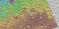
 Ismeniae Fossae (PIA25945).png 201 × 223; 118 KB
-
 Ismenius lacus.JPG 642 × 372; 44 KB
-
 Mamers Valles (PIA25872 fig1).png 200 × 334; 167 KB
-
 Mamers Valles colour-coded elevation model ESA226225.tiff 6,577 × 4,000; 51.66 MB
-
 Mapdeuteronilus.jpg 1,908 × 726; 659 KB
-
 PIA00165-Mars-MC-5-IsmeniusLacusRegion-19980604.jpg 6,994 × 5,029; 2.75 MB
-
 Protonilus Mensae (PIA25929 fig1).png 200 × 334; 176 KB
-
 Terra Sabaea Channels (PIA25993).png 201 × 335; 180 KB
-
 Topographic view of Deuteronilus Mensae ESA21464228.tiff 10,939 × 4,000; 70.38 MB
-
 USGS-Mars-MC-5-IsmeniusLacusRegion-mola.png 2,999 × 2,999; 6.27 MB
-
 Wikilyotmola.jpg 1,902 × 937; 853 KB
-
 Wikirudauxmola.jpg 1,902 × 935; 828 KB
.png)

.png)

.png)

.png)
.png)


