Category:Maps of Kherson Governorate
Wikimedia category | |||||
| Upload media | |||||
| Instance of | |||||
|---|---|---|---|---|---|
| Category combines topics | |||||
| Kherson Governorate | |||||
region of the Russian Empire   .svg) | |||||
| Instance of | |||||
| Location |
| ||||
| Capital | |||||
| Inception |
| ||||
| Dissolved, abolished or demolished date |
| ||||
| Population |
| ||||
| Followed by |
| ||||
| Replaces | |||||
| Replaced by | |||||
 | |||||
Subcategories
This category has the following 2 subcategories, out of 2 total.
*
- Old maps of Kherson Governorate (12 F)
S
Media in category "Maps of Kherson Governorate"
The following 18 files are in this category, out of 18 total.
-
 Herson gub ananyiv.png 406 × 348; 8 KB
-
 Herson gub blank.png 406 × 348; 8 KB
-
 Herson gub odesa.png 406 × 348; 8 KB
-
 Herson gub oleksandria.png 406 × 348; 8 KB
-
 Herson gub tyraspol.png 406 × 348; 8 KB
-
 Herson gub yelysavetgrad.png 406 × 348; 8 KB
-
 Herson gub.png 1,269 × 1,064; 48 KB
-
 Kherson Governorate Aleksandriysky uezd.svg 1,572 × 1,320; 125 KB
-
 Kherson Governorate Ananevsky uezd.svg 1,572 × 1,320; 125 KB
-
 Kherson Governorate Elisavetgradsky uezd.svg 1,572 × 1,320; 125 KB
-
 Kherson Governorate Khersonsky uezd.svg 1,572 × 1,320; 125 KB
-
 Kherson Governorate Odessky uezd.svg 1,572 × 1,320; 125 KB
-
 Kherson Governorate Tiraspolsky uezd.svg 1,572 × 1,320; 125 KB
-
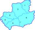
 Kherson Governorate.svg 1,572 × 1,320; 125 KB
-
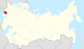 Kherson in Russian Empire (1914).svg 581 × 343; 310 KB
-
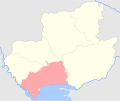
 Ukrainian language in Kherson Governorate, 1897.svg 1,572 × 1,320; 127 KB
-
 Довгинцеве на карті середини ХІХ ст..jpg 585 × 464; 139 KB
-
 Олександрійський повіт.jpg 1,288 × 1,162; 724 KB


