Category:Maps of Lake County, Florida (dot)
Media in category "Maps of Lake County, Florida (dot)"
The following 23 files are in this category, out of 23 total.
-
 FLMap-doton-Altoona.PNG 300 × 295; 12 KB
-
 FLMap-doton-Astatula.PNG 300 × 295; 12 KB
-
 FLMap-doton-Clermont.PNG 300 × 295; 12 KB
-
 FLMap-doton-Ferndale.PNG 300 × 295; 12 KB
-
 FLMap-doton-FruitlandPark.PNG 300 × 295; 12 KB
-
 FLMap-doton-Groveland.PNG 300 × 295; 12 KB
-
 FLMap-doton-Howey-in-the-Hills.PNG 300 × 295; 12 KB
-
 FLMap-doton-LadyLake.PNG 300 × 295; 12 KB
-
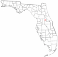
 FLMap-doton-LakeKathryn.PNG 300 × 295; 12 KB
-
 FLMap-doton-LakeMack-ForestHills.PNG 300 × 295; 12 KB
-
 FLMap-doton-Leesburg.PNG 300 × 295; 12 KB
-
 FLMap-doton-Lisbon.PNG 300 × 295; 12 KB
-
 FLMap-doton-Mascotte.PNG 300 × 295; 12 KB
-
 FLMap-doton-Montverde.PNG 300 × 295; 12 KB
-
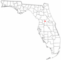
 FLMap-doton-MountPlymouth.PNG 300 × 295; 12 KB
-
 FLMap-doton-Okahumpka.PNG 300 × 295; 12 KB
-
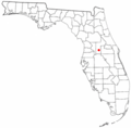
 FLMap-doton-Paisley.PNG 300 × 295; 12 KB
-
 FLMap-doton-PineLakes.PNG 300 × 295; 12 KB
-
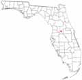
 FLMap-doton-Pittman.PNG 300 × 295; 12 KB
-
 FLMap-doton-Sorrento.PNG 300 × 295; 12 KB
-
 FLMap-doton-Tavares.PNG 300 × 295; 12 KB
-
 FLMap-doton-Umatilla.PNG 300 × 295; 12 KB
-
 FLMap-doton-Yalaha.PNG 300 × 295; 12 KB


