Category:Maps of Landkreis Main-Spessart
Urban districts (cities): Amberg · Ansbach · Aschaffenburg · Augsburg · Bamberg · Bayreuth · Coburg · Erlangen · Fürth · Hof · Ingolstadt · Kaufbeuren · Kempten · Landshut · Memmingen · Munich · Nuremberg · Passau · Regensburg · Rosenheim · Schweinfurt · Straubing · Weiden in der Oberpfalz · Würzburg
Subcategories
This category has the following 3 subcategories, out of 3 total.
K
- Maps of Kreuzwertheim (empty)
Media in category "Maps of Landkreis Main-Spessart"
The following 2 files are in this category, out of 2 total.
-
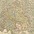 Karte Amt Rothenfels 1836.jpg 900 × 909; 782 KB
-
 Landkreis Main-Spessart Gemeinden und Gemarkungen.jpg 3,325 × 3,897; 2.07 MB

