Category:Maps of Long Beach Island
Media in category "Maps of Long Beach Island"
The following 20 files are in this category, out of 20 total.
-
 Long-beach-island-map-with-locales.png 580 × 580; 48 KB
-
 Beach changes at Long Beach Island, New Jersey, 1962-73 (1980) (20170558860).jpg 1,730 × 2,274; 540 KB
-
 Beach changes at Long Beach Island, New Jersey, 1962-73 (1980) (20170560940).jpg 1,796 × 2,232; 588 KB
-
 Beach changes at Long Beach Island, New Jersey, 1962-73 (1980) (20170562750).jpg 1,660 × 1,972; 459 KB
-
 Beach changes at Long Beach Island, New Jersey, 1962-73 (1980) (20350114232).jpg 1,578 × 2,186; 530 KB
-
 Beach changes at Long Beach Island, New Jersey, 1962-73 (1980) (20358618215).jpg 1,490 × 2,064; 431 KB
-
 Census Bureau map of Barnegat Light, New Jersey.png 575 × 425; 27 KB
-
 Census Bureau map of Beach Haven, New Jersey.png 575 × 425; 20 KB
-
 Census Bureau map of Harvey Cedars, New Jersey.png 575 × 425; 27 KB
-
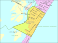
 Census Bureau map of Long Beach Township, New Jersey.png 575 × 425; 42 KB
-
 Census Bureau map of Ship Bottom, New Jersey.png 575 × 425; 31 KB
-
 Census Bureau map of Surf City, New Jersey.png 575 × 425; 32 KB
-
 Deep sea fishing grounds (1915) (20224911303).jpg 2,944 × 1,884; 539 KB
-
 Long beach twp nj 029.png 580 × 580; 49 KB
-
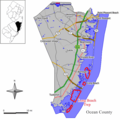
 LongBeachIsland.svg 1,864 × 1,967; 25 KB
-

-

-

-
 Ship bottom nj 029.png 580 × 580; 48 KB
-
 Surf city nj 029.png 580 × 580; 48 KB

_(20170558860).jpg)
_(20170560940).jpg)
_(20170562750).jpg)
_(20350114232).jpg)
_(20358618215).jpg)


_(20224911303).jpg)


