Category:Maps of Lortet (Hautes-Pyrénées)
Subcategories
This category has the following 6 subcategories, out of 6 total.
Media in category "Maps of Lortet (Hautes-Pyrénées)"
The following 6 files are in this category, out of 6 total.
-
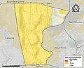
 65279-Lortet - Localisation.png 2,000 × 2,480; 1.04 MB
-
 65279-Lortet-argile.jpg 3,057 × 2,480; 438 KB
-
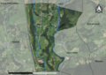 65279-Lortet-Orthophoto.png 7,015 × 4,960; 4.71 MB
-
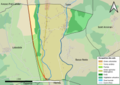 65279-Lortet-Sols.png 7,015 × 4,960; 3.35 MB
-
 Localisation de Lortet dans les Hautes-Pyrénées 1.pdf 1,754 × 2,481; 617 KB
-
 Map commune FR insee code 65279.png 756 × 605; 36 KB


