<nowiki>Category:Maps of Marblehead, Massachusetts; categoría de Wikimedia; kategori Wikimedia; Wikimedia category; د ويکيمېډيا وېشنيزه; Vikimedya kategorisi; ویکیمیڈیا زمرہ; kategória projektov Wikimedia; категорія проєкту Вікімедіа; 维基媒体分类; Wikimedia-Kategorie; Викимедиина категорија; kategorija na Wikimediji; विकिपीडिया:श्रेणी; page de catégorie de Wikimedia; kategorija na Wikimediji; विकिपीडिया वर्ग; категорија на Викимедији; Wikimedia-Kategorie; Wikimedia-kategori; kategori Wikimédia; تصنيف ويكيميديا; pajenn rummata eus Wikimedia; Wikimedia:ကဏ္ဍခွဲခြင်း; 維基媒體分類; Wikimedia категориясы; categoría de Wikimedia; Wikimedia-Kategorie; Викимедиа категорияһы; tudalen categori Wikimedia; kategori e Wikimedias; Վիքիմեդիայի նախագծի կատեգորիա; 维基媒体分类; Wikimedia-kategori; ვიკიპედია:კატეგორიზაცია; ウィキメディアのカテゴリ; categoria Wikimedia; تصنيف بتاع ويكيميديا; විකිමීඩියා ප්රභේද පිටුව; categoria Vicimediorum; Vikipidiya:Shopni; Wikimedia-luokka; Wikimedia category; guruhi Vikimedia; катэгорыя ў праекце Вікімэдыя; Викимедиа проектындагы төркем; catigurìa di nu pruggettu Wikimedia; หน้าหมวดหมู่วิกิมีเดีย; Wikimedia:Kategorija; Wikimedia-Kategorie; Wikimedia:Klassys; категория на Уикимедия; categorie a unui proiect Wikimedia; categurìa 'e nu pruggette Wikimedia; Wikimedia-kategori; kawan Wikimèdia; гурӯҳи Викимедиа; 위키미디어 분류; Wikimedia-bólkur; kategorio en Vikimedio; kategori Wikimedia; Wikimedia:Ronnaghys; উইকিমিডিয়া বিষয়শ্রেণী; kategori Wikimedia; 维基媒体分类; וויקימעדיע קאַטעגאָריע; kategorija w projektach Wikimedije; thể loại Wikimedia; Wikimedia projekta kategorija; kategoria ti Wikimedia; categoria de um projeto da Wikimedia; 维基媒体分类; категорияд Ангилал; Wikimedia-kategori; kategori Wikimedia; پۆلی ویکیمیدیا; Wikimedia category; Vikimédia ñemohenda; Wikimédia-kategória; વિકિપીડિયા શ્રેણી; Wikimediako kategoria; категория в проекте Викимедиа; Wikimedia-Kategorie; катэгорыя ў праекце Вікімедыя; Wikimedia-kategorie; Wîkîmediya:Kategorî; विकिमिडिया श्रेणी; Wikimedia-Kategorie; קטגוריה במיזמי ויקימדיה; Викимедиа проектындагы төркем; κατηγορία εγχειρημάτων Wikimedia; विकिमिडिया श्रेणी; kategoria w projekcie Wikimedia; Wikimedia-kategoriija; гурӯҳи Викимедиа; Wikimedia-categorie; categoría de Wikimedia; Wikimedia-categorie; categoria di un progetto Wikimedia; விக்கிமீடியப் பகுப்பு; Viciméid catagóir; 維基媒體分類; Wikimedia kategooria; categoria de Wikimedia; ردهٔ ویکیپدیا; Wikimedia proyektındağı törkem; 維基媒體分類; ẹ̀ka Wikimedia; kategorie na projektech Wikimedia; categoria de um projeto da Wikimedia; Wikimedia-Kategorie; Wikimedia-categorie; tumbung Wikimedia; Wikimedia-kategorie; kategorija Wikimedije; kategorya ng Wikimedia; Kategoriya ning Wikimedia; Wikimedia category; kategori Wikimedia; jamii ya Wikimedia; വിക്കിമീഡിയ വർഗ്ഗം; 維基媒體分類; kategori Wikimedia; Wikimedia-Kategorie; زمرو:وڪيپيڊيا زمرا بندي; Wikimedia-kategory; categoría de Wikimedia; 維基媒體分類; 维基媒体分类; विकिमीडिया श्रेणी</nowiki>
Subcategories
This category has only the following subcategory.


 1834 SalemHarbor MA byNathanielBowditch BPL 10921.png 935 × 718; 935 KB
 Admiralty Chart No 2427 Massachusetts Salem Harbour, Published 1867.jpg 8,083 × 6,002; 7.02 MB
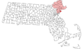 Marblehead ma highlight.png 788 × 466; 54 KB
 Plan of Marblehead, Mass. from actual survey (7557392026).jpg 4,840 × 6,160; 23.94 MB


.jpg)