Category:Maps of Mole Valley District
Media in category "Maps of Mole Valley District"
The following 8 files are in this category, out of 8 total.
-
 Bookham Lodge Map 1839.jpg 962 × 1,280; 379 KB
-
 Dorking and Leatherhead unparished area UK locator map.svg 990 × 1,266; 433 KB
-
 Mole Valley UK local election 2021 map.svg 990 × 1,266; 417 KB
-
 Mole Valley UK locator map.svg 1,425 × 1,081; 948 KB
-
 Mole Valley UK ward map 2010 (blank).svg 990 × 1,266; 415 KB
-
 River Mole Map.png 447 × 544; 67 KB
-
 River Mole Map.svg 450 × 515; 269 KB
-
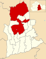
 SurreyMoleValley.png 200 × 142; 13 KB


.svg)