Category:Maps of Mukhavka
| NO WIKIDATA ID FOUND! Search for Maps of Mukhavka on Wikidata | |
| Upload media |
Media in category "Maps of Mukhavka"
The following 3 files are in this category, out of 3 total.
-
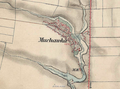 Galicia and Bucovina (1861–1864). Muchawka.png 1,196 × 890; 1.65 MB
-
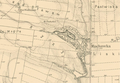 Habsburg Empire (1869-1887). Muchawka & Filwarki.png 1,598 × 1,105; 2.46 MB
-
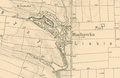 Habsburg Empire (1869-1887). Muchawka.png 1,380 × 900; 1.71 MB
._Muchawka.png)
._Muchawka_%26_Filwarki.png)
._Muchawka.png)