Category:Maps of Northampton County, Pennsylvania (style A)
Media in category "Maps of Northampton County, Pennsylvania (style A)"
The following 35 files are in this category, out of 35 total.
-

-
 Map of Bangor, Northampton County, Pennsylvania Highlighted.png 464 × 477; 30 KB
-
 Map of Bath, Northampton County, Pennsylvania Highlighted.png 464 × 477; 30 KB
-

-

-
 Map of Chapman, Northampton County, Pennsylvania Highlighted.png 464 × 477; 30 KB
-

-
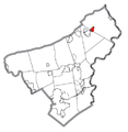 Map of East Bangor, Northampton County, Pennsylvania Highlighted.png 464 × 477; 30 KB
-
 Map of Easton, Northampton County, Pennsylvania Highlighted.PNG 464 × 477; 30 KB
-

-

-
 Map of Glendon, Northampton County, Pennsylvania Highlighted.png 464 × 477; 30 KB
-
 Map of Hellertown, Northampton County, Pennsylvania Highlighted.png 464 × 477; 29 KB
-

-

-

-

-

-
 Map of Nazareth, Northampton County, Pennsylvania Highlighted.png 464 × 477; 29 KB
-

-
 Map of Northampton, Northampton County, Pennsylvania Highlighted.png 464 × 477; 29 KB
-
 Map of Pen Argyl, Northampton County, Pennsylvania Highlighted.PNG 464 × 477; 30 KB
-
 Map of Pennsylvania highlighting Northampton County.svg 1,980 × 1,138; 96 KB
-

-
 Map of Portland, Northampton County, Pennsylvania Highlighted.png 464 × 477; 29 KB
-
 Map of Roseto, Northampton County, Pennsylvania Highlighted.png 464 × 477; 30 KB
-
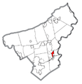
 Map of Stockertown, Northampton County, Pennsylvania Highlighted.png 464 × 477; 29 KB
-
 Map of Tatamy, Northampton County, Pennsylvania Highlighted.png 464 × 477; 29 KB
-

-

-
 Map of Walnutport, Northampton County, Pennsylvania Highlighted.png 464 × 477; 29 KB
-
 Map of West Easton, Northampton County, Pennsylvania Highlighted.png 464 × 477; 30 KB
-
 Map of Wilson, Northampton County, Pennsylvania Highlighted.png 464 × 477; 30 KB
-
 Map of Wind Gap, Northampton County, Pennsylvania Highlighted.png 464 × 477; 29 KB
-


