Category:Maps of Orbigny (Indre-et-Loire)
Subcategories
This category has only the following subcategory.
Media in category "Maps of Orbigny (Indre-et-Loire)"
The following 9 files are in this category, out of 9 total.
-
 37177-Orbigny-argile.png 3,057 × 2,480; 3.99 MB
-
 37177-Orbigny-Cours eau.jpg 3,507 × 2,480; 632 KB
-
 Cartes Orbigny.png 320 × 362; 15 KB
-
 Map commune FR insee code 37177.png 756 × 605; 104 KB
-
 Orbigny canton.svg 1,000 × 1,091; 132 KB
-
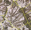 Orbigny Cassini.jpg 611 × 597; 134 KB
-
 Orbigny enclos.svg 709 × 508; 51 KB
-
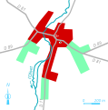 Orbigny urbanisme.svg 889 × 899; 31 KB
-
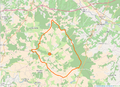 OSM-Orbigny.png 978 × 709; 508 KB


