Category:Maps of Päijänne Tavastia
Subcategories
This category has the following 3 subcategories, out of 3 total.
Media in category "Maps of Päijänne Tavastia"
The following 12 files are in this category, out of 12 total.
-

-
 Finland Päijät-Häme Region 2021.svg 612 × 850; 2.15 MB
-
 Finland Päijät-Häme Region.svg 1,000 × 1,395; 68 KB
-
 Finland regions Päijät-Häme.png 1,424 × 2,528; 802 KB
-
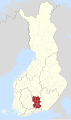
 Location of Päijät-Häme in Finland.png 230 × 400; 4 KB
-
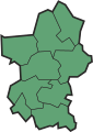
 Päijät häme.png 2,000 × 3,500; 369 KB
-
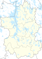
 Päijät-Häme 1996.svg 598 × 850; 2.23 MB
-
 Päijät-Häme 2011 clean.svg 353 × 500; 6 KB
-
 Päijät-Häme 2016 clean.svg 353 × 500; 5 KB
-
 Päijät-Häme.diocesan chapter.location.2022.svg 512 × 863; 1.04 MB
-
 Päijät-Häme.sijainti.suomi.2010.svg 1,850 × 3,220; 64 KB
-
 Päijät-Hämeen.maakunta.suomi.2008.svg 1,850 × 3,220; 269 KB
%27_(11301984904).jpg)


