Category:Maps of Palestine in 10th century BC
Media in category "Maps of Palestine in 10th century BC"
The following 13 files are in this category, out of 13 total.
-

-

-
 Early-Historical-Israel-Dan-Beersheba-Judea-Corrected.png 860 × 1,011; 41 KB
-
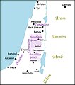
 Early-Historical-Israel-Dan-Beersheba-Judea.png 860 × 1,210; 58 KB
-
 Israelites XeSiecle.jpg 595 × 673; 83 KB
-
 Map Israel Judea 926 BC-es.svg 554 × 918; 1.92 MB
-
 Map Israel Judea 926 BC-fr.svg 554 × 918; 1.8 MB
-
 Map Israel Judea 926 BC-hu.svg 554 × 918; 1.57 MB
-
 Map Israel Judea 926 BC-pl.svg 554 × 918; 1.01 MB
-
 Map Israel Judea 926 BC-ur.png 554 × 918; 480 KB
-
 Mapa kraju Filistynów.JPG 363 × 573; 27 KB
-
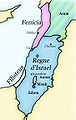 Regne d'Israel.jpg 363 × 573; 21 KB
-
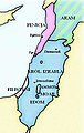
 SheshonqI Canaan.jpg 657 × 770; 123 KB
%27_(11250569495).jpg)


