Category:Maps of Paris from Geographicus
Media in category "Maps of Paris from Geographicus"
The following 62 files are in this category, out of 62 total.
-
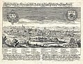 1650 Schnitzer view of Paris.jpg 4,000 × 3,116; 4.31 MB
-

-
-
 1675 Rochefort Map of Paris.jpg 9,000 × 7,490; 24.9 MB
-
 1710 Jaillot Map of Paris.jpg 5,704 × 5,800; 10.8 MB
-

-

-

-
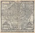
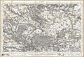
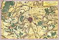 1780 Bonne Map of the Environs of Paris, France - Geographicus - Paris-bonne-1780 (2).jpg 3,783 × 2,567; 5.93 MB
-
 1780 Bonne Map of the Environs of Paris, France - Geographicus - Paris-bonne-1780.jpg 4,000 × 2,762; 2.09 MB
-
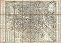 1780 Esnauts and Rapilly Case Map of Paris - Geographicus - Paris-esnautsrapilly-1780.jpg 4,986 × 3,514; 12.57 MB
-
 1782 Esnauts and Rapilly Map of Paris.jpg 5,000 × 3,513; 7.61 MB
-
 1797 Jean Map of Paris and the Faubourgs, France - Geographicus - Paris-jean-1797.jpg 6,000 × 3,938; 9.78 MB
-

-
 1850 Andriveau-Goujon Map of Paris and Environs - Geographicus - Paris-goujon-1850.jpg 5,033 × 3,569; 10.25 MB
-

-

-

-
 1855 Colton Map or City Plan of Paris, France - Geographicus - Paris-c-55.jpg 3,000 × 2,451; 2.84 MB
-
 1857 Colton Map of Paris, France - Geographicus - Paris-cbl-1855.jpg 3,500 × 2,855; 2.92 MB
-

-
 1860 Andriveau Goujon Case Map of Paris, France - Geographicus - Paris-andriveau-1860.jpg 6,000 × 4,440; 8.98 MB
-

-
 1862 Vuillemin Map of Paris.jpg 8,500 × 6,699; 18.19 MB
-
 1863 Henriot Pocket Map of Paris, France - Geographicus - Paris-henriot-1863.jpg 6,000 × 4,166; 12.56 MB
-
 1864 Garnier Map of Pairs, France w-Monuments - Geographicus - Paris-garnier-1864.jpg 5,000 × 3,790; 5.93 MB
-

-
 1867 Fichot bird's eye view of Paris.jpg 9,000 × 6,132; 20.3 MB
-
 1867 Ledot Pocket Map of Paris, France - Geographicus - Paris-ledot-1867.jpg 6,000 × 4,110; 7.86 MB
-
 1867 Logerot Map of Paris, France - Geographicus - Paris-logerot-1867.jpg 6,000 × 4,652; 9.97 MB
-
 1870 Erhard Map of Paris and Vicinity, France - Geographicus - Paris-erhard-1870.jpg 4,000 × 3,084; 3.96 MB
-
 1870 Hachette Pocket Map of Paris, France - Geographicus - NouveauParis-hachette-1870.jpg 7,000 × 5,910; 10.41 MB
-
 1870 Vuillemin Map of Paris.jpg 8,000 × 6,811; 15.11 MB
-
 1877 Vuillemin Folding Pocket Map of Paris, France - Geographicus - Paris-vuillemin-1877.jpg 5,962 × 4,136; 8.85 MB
-
 1878 Andriveau-Goujon Pocket Map of Paris, France - Geographicus - Paris-andriveau-1878.jpg 6,000 × 4,532; 8.79 MB
-
 1878 Logerot Map of Paris, France - Geographicus - Paris-logerot-1878.jpg 6,000 × 4,099; 7.61 MB
-
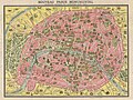
 1878 Testard pictorial map of Paris with monuments.jpg 6,123 × 5,000; 14.15 MB
-
 1880 Clerot Pocket Map of Paris and Environs, France - Geographicus - Paris-clerot-1880.jpg 5,904 × 4,216; 16.09 MB
-
 1881 Lefevre Pocket Map or Plan of Paris, France - Geographicus - Paris-lefevre-1881.jpg 5,000 × 3,765; 6.34 MB
-
 1882 Andriveau-Goujon Pocket Map of Paris, France - Geographicus - Paris-andriveau-1882.jpg 6,000 × 4,570; 10.58 MB
-
-
 1889 Vuillemin Map of Paris, France - Geographicus - Paris-vuillemin-1889.jpg 6,000 × 4,173; 8.24 MB
-
 1892 Hachette Plan or Pocket Map of Paris, France - Geographicus - Paris-hachette-1892.jpg 6,000 × 5,037; 27.71 MB
-

-

-

-
 1902 L'Armee Case Map of Paris and Environs - Geographicus - Paris-armee-1902.jpg 6,000 × 5,078; 8.95 MB
-
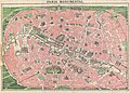
 1910 Leconte Monument Map of Paris, France - Geographicus - ParisMonumental-leconte-1910.jpg 5,000 × 3,689; 5.94 MB
-

-
-
 1920 Robelin Map of Paris, France - Geographicus - Paris-robelin-1920.jpg 5,000 × 3,749; 14.88 MB
-

-

-
-

-

-

-

-

-

-
 Guilmin map of Paris, France, Monuments - Geographicus - Paris-Guilmin.jpg 5,000 × 3,680; 5.84 MB
-


_-_Geographicus_-_Paris-gomboust-1900.jpg)
_-_Geographicus_-_ParisSm-gomboust-1900.jpg)


_-_Geographicus_-_Paris-turgot-1900.jpg)
_-_Geographicus_-_Paris-turgot-1909.jpg)

.jpg)


_-_Geographicus_-_SeineEtOise-levasseur-1852.jpg)


_-_Geographicus_-_Paris-galignani-1865.jpg)


_-_Geographicus_-_Paris-hachette-1894.jpg)
_-_Geographicus_-_Paris-garnier-1900.jpg)
_-_Geographicus_-_NouveauParisMonumental-garnier-1900.jpg)


_-_Geographicus_-_Paris-leconte-1820.jpg)


.jpg)