Category:Maps of Pennsylvania state forests
Media in category "Maps of Pennsylvania state forests"
The following 15 files are in this category, out of 15 total.
-
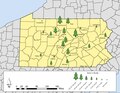
 Bald Eagle State Forest.png 1,509 × 1,156; 190 KB
-
 Bucktail State Park.PNG 288 × 168; 26 KB
-
 Clear Creek State Forest Locator Map.PNG 964 × 554; 35 KB
-
 Delaware State Forest Locator Map.PNG 964 × 554; 36 KB
-
 Elk State Forest.png 1,040 × 797; 56 KB
-
 Forbes State Forest Locator Map.PNG 964 × 554; 36 KB
-
 Gallitzin State Forest Locator Map.PNG 964 × 554; 35 KB
-
 Lackawanna State Forest Locator Map.PNG 964 × 554; 35 KB
-
 Lehigh Gorge State Park.PNG 288 × 168; 26 KB
-
 Loyalsock State Forest Locator Map.PNG 964 × 554; 36 KB
-
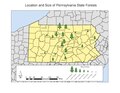
 Size and Location of State Forests.pdf 1,650 × 1,275; 280 KB
-
 State Forests.pdf 1,650 × 1,275; 281 KB
-
 Tioga State Forest Locator Map.PNG 964 × 554; 36 KB
-
 Weiser State Forest Locator Map.PNG 964 × 554; 36 KB
-
 William Penn State Forest Locator Map.PNG 964 × 554; 36 KB


