Category:Maps of Port Elizabeth
Media in category "Maps of Port Elizabeth"
The following 9 files are in this category, out of 9 total.
-

-
-
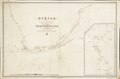
 Admiralty Chart No 641 Approaches to Port Elizabeth, Published 1938.jpg 16,251 × 11,116; 35.57 MB
-
 Nelson Mandela Bay 2001 dominant language map.svg 991 × 793; 614 KB
-
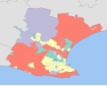 Nelson Mandela Bay 2001 dominant population group map.svg 991 × 793; 614 KB
-
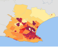 Nelson Mandela Bay 2001 population density map.svg 991 × 793; 1.15 MB
-
 Nelson Mandela Bay 2011 population density map.svg 913 × 822; 157 KB
-
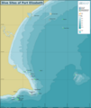 Port Elizabeth dive sites map.png 3,697 × 4,371; 1.05 MB
-
 Port Elizabeth Tracks.png 1,334 × 294; 333 KB
.jpg)


