Category:Maps of Quebec provincial electoral districts
Media in category "Maps of Quebec provincial electoral districts"
The following 60 files are in this category, out of 60 total.
-
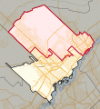
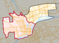
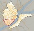
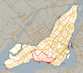
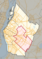
 39e législature du Québec - Montréal et Laval - Laval-des-Rapides.svg 4,806 × 3,195; 509 KB
-
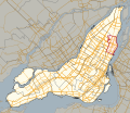
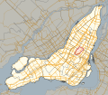
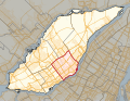
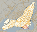
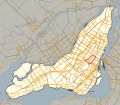
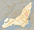
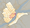
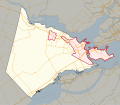
 Circonscription électorale Taschereau.png 2,732 × 2,067; 933 KB
-
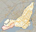
 Jonquiere-Alma.png 559 × 627; 24 KB
-
 Laurier-Dorion2.jpg 453 × 540; 26 KB
-
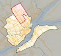
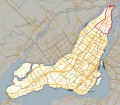
 Quebec 2011 Acadie.svg 677 × 588; 20.39 MB
-
 Quebec 2011 Anjou-Louis-Riel.svg 677 × 588; 20.41 MB
-
 Quebec 2011 Blainville.svg 170 × 186; 4.49 MB
-
 Quebec 2011 Bourassa-Sauvé.svg 677 × 588; 20.38 MB
-
 Quebec 2011 Bourget.svg 677 × 588; 20.4 MB
-
 Quebec 2011 Chapleau.svg 209 × 152; 4.37 MB
-
 Quebec 2011 Charlesbourg.svg 332 × 304; 7.07 MB
-
 Quebec 2011 Chicoutimi.svg 238 × 142; 5.12 MB
-
 Quebec 2011 Chomedey.svg 346 × 265; 13.05 MB
-
 Quebec 2011 Châteauguay.svg 148 × 151; 1.13 MB
-
 Quebec 2011 D'Arcy-McGee.svg 677 × 588; 20.41 MB
-
 Quebec 2011 Fabre.svg 346 × 265; 13.07 MB
-
 Quebec 2011 Gouin.svg 677 × 588; 20.4 MB
-
 Quebec 2011 Groulx.svg 170 × 186; 4.52 MB
-
 Quebec 2011 Hochelaga-Maisonneuve.svg 677 × 588; 20.38 MB
-
 Quebec 2011 Hull.svg 209 × 152; 4.38 MB
-
 Quebec 2011 Jacques-Cartier.svg 677 × 588; 20.44 MB
-
 Quebec 2011 Jean-Lesage.svg 332 × 304; 7.08 MB
-
 Quebec 2011 Jean-Talon.svg 332 × 304; 7.08 MB
-
 Quebec 2011 Jeanne-Mance-Viger.svg 677 × 588; 20.41 MB
-
 Quebec 2011 Jonquière.svg 238 × 142; 5.12 MB
-
 Quebec 2011 L'Assomption.svg 178 × 203; 4.95 MB
-
 Quebec 2011 La Pinière.svg 224 × 314; 8.64 MB
-
 Quebec 2011 LaFontaine.svg 677 × 588; 20.4 MB
-
 Quebec 2011 Laporte.svg 224 × 314; 8.64 MB
-
 Quebec 2011 Laurier-Dorion.svg 677 × 588; 20.39 MB
-
 Quebec 2011 Laval-des-Rapides.svg 346 × 265; 13.04 MB
-
 Quebec 2011 Lévis.svg 332 × 304; 7.09 MB
-
 Quebec 2011 Marguerite-Bourgeoys.svg 677 × 588; 20.4 MB
-
 Quebec 2011 Marie-Victorin.svg 224 × 314; 8.64 MB
-
 Quebec 2011 Marquette.svg 677 × 588; 20.43 MB
-
 Quebec 2011 Maurice-Richard.svg 677 × 588; 20.39 MB
-
 Quebec 2011 Mercier.svg 677 × 588; 20.39 MB
-
 Quebec 2011 Mille-Îles.svg 346 × 265; 13.08 MB
-
 Quebec 2011 Mont-Royal-Outremont.svg 677 × 588; 20.41 MB
-
 Quebec 2011 Montarville.svg 224 × 314; 8.68 MB
-
 Quebec 2011 Nelligan.svg 677 × 588; 20.45 MB
-
 Quebec 2011 Notre-Dame-de-Grâce.svg 677 × 588; 20.42 MB
-
 Quebec 2011 Pointe-aux-Trembles.svg 677 × 588; 20.41 MB
-
 Quebec 2011 Repentigny.svg 178 × 203; 4.96 MB
-
 Quebec 2011 Robert-Baldwin.svg 677 × 588; 20.4 MB
-
 Quebec 2011 Rosemont.svg 677 × 588; 20.39 MB
-
 Quebec 2011 Saint-Henri-Sainte-Anne.svg 677 × 588; 20.42 MB
-
 Quebec 2011 Saint-Laurent.svg 677 × 588; 20.42 MB
-
 Quebec 2011 Sainte-Marie-Saint-Jacques.svg 677 × 588; 20.4 MB
-
 Quebec 2011 Sainte-Rose.svg 346 × 265; 13.06 MB
-
 Quebec 2011 Soulanges.svg 201 × 175; 10.14 MB
-
 Quebec 2011 Taillon.svg 224 × 314; 8.64 MB
-
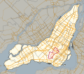
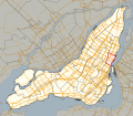
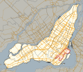
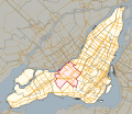
 Quebec 2011 Taschereau.svg 332 × 304; 7.08 MB
-
 Quebec 2011 Vachon.svg 224 × 314; 8.64 MB
-
 Quebec 2011 Vanier-Les Rivières.svg 332 × 304; 7.1 MB
-
 Quebec 2011 Vaudreuil.svg 201 × 175; 10.09 MB
-
 Quebec 2011 Verdun.svg 677 × 588; 20.4 MB
-
 Quebec 2011 Viau.svg 677 × 588; 20.39 MB
-
 Quebec 2011 Vimont.svg 346 × 265; 13.06 MB
-
 Quebec 2011 Westmount-Saint-Louis.svg 677 × 588; 20.4 MB


