Category:Maps of Queyrac (Gironde)
Media in category "Maps of Queyrac (Gironde)"
The following 6 files are in this category, out of 6 total.
-
 33348-Queyrac-relief.png 3,057 × 2,480; 4.2 MB
-
 33348-Queyrac-Routes-Hydro.png 3,507 × 2,480; 2.66 MB
-
 33348-Queyrac-Sols.png 3,270 × 2,598; 2.69 MB
-
 33348-Queyrac-ZNIEFF2.png 5,866 × 4,133; 8.51 MB
-
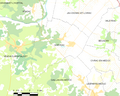 Map commune FR insee code 33348.png 756 × 605; 61 KB
-
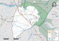
 Queyrac Limite communale.jpg 956 × 581; 143 KB


