Category:Maps of Regions in Somalia
Media in category "Maps of Regions in Somalia"
The following 60 files are in this category, out of 60 total.
-
 Somalia regions map.svg 744 × 1,052; 28 KB
-
 A map of Somalia regions.svg 1,162 × 1,468; 30 KB
-
 Administrative divisions of Somalia.svg 1,000 × 1,318; 19 KB
-
 Bakool, Somalia.svg 1,000 × 1,318; 11 KB
-
 Banaadir, Somalia.svg 1,000 × 1,318; 12 KB
-
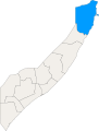 Bari, Somalia.svg 1,000 × 1,318; 11 KB
-
 Base Map of Somalia.png 749 × 1,002; 337 KB
-
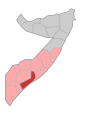
 Bay, Somalia.svg 1,000 × 1,318; 11 KB
-
 Blank Somalia Map.svg 1,000 × 1,318; 11 KB
-
 Galguduud, Somalia.svg 1,000 × 1,318; 11 KB
-
 Galmudug map.svg 1,000 × 1,318; 12 KB
-
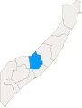
 Gedo, Somalia.svg 1,000 × 1,318; 11 KB
-
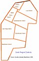 Gedodistricts.jpg 373 × 579; 92 KB
-
 Hiiraan, Somalia.svg 1,000 × 1,318; 11 KB
-
 Hirshabelle map.svg 1,000 × 1,318; 11 KB
-
 Jubaland map.svg 1,000 × 1,318; 11 KB
-
 Jubbada Dhexe, Somalia.svg 1,000 × 1,318; 11 KB
-
 Jubbada Hoose, Somalia.svg 1,000 × 1,318; 11 KB
-
 Karte der Landesteile Somalias.png 1,466 × 1,853; 117 KB
-
 Khatumo State-administrative map EN.gif 860 × 736; 58 KB
-
 Location of Bohotle District.gif 935 × 650; 47 KB
-
 Map of Somalia with States flags.svg 1,000 × 1,318; 223 KB
-
 Somalia-Mogadishu.png 426 × 585; 19 KB
-
 Mudug, Somalia.svg 1,000 × 1,318; 11 KB
-
 Nugaal, Somalia.svg 1,000 × 1,318; 11 KB
-
 Puntland map.svg 1,000 × 1,318; 12 KB
-
 Regions of Somalia.svg 1,000 × 1,318; 18 KB
-
 Shabeellaha Dhexe, Somalia.svg 1,000 × 1,318; 11 KB
-
 Shabeellaha Hoose, Somalia.svg 1,000 × 1,318; 11 KB
-
 So-kaart.jpg 450 × 524; 28 KB
-
 Somalia Base Map.png 2,365 × 2,802; 300 KB
-
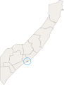
 Somalia Bay.gif 481 × 728; 9 KB
-
 Somalia map states regions districts.svg 512 × 541; 1.15 MB
-
 Somalia regions map Awdal.svg 744 × 1,052; 29 KB
-
 Somalia regions map Ayn.svg 744 × 1,052; 37 KB
-
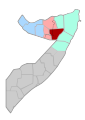
 Somalia regions map Bakool.svg 744 × 1,052; 28 KB
-
 Somalia regions map Banaadir.svg 744 × 1,052; 28 KB
-
 Somalia regions map Bari.svg 744 × 1,052; 29 KB
-
 Somalia regions map Galguduud.svg 744 × 1,052; 28 KB
-
 Somalia regions map Gedo.svg 744 × 1,052; 28 KB
-
 Somalia regions map Hiiraan.svg 744 × 1,052; 28 KB
-
 Somalia regions map Jubbada Dhexe.svg 744 × 1,052; 28 KB
-
 Somalia regions map Jubbada Hoose.svg 744 × 1,052; 28 KB
-
 Somalia regions map Mudug.svg 744 × 1,052; 29 KB
-
 Somalia regions map Nugaal.svg 744 × 1,052; 29 KB
-
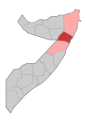
 Somalia regions map Sanaag.svg 744 × 1,052; 29 KB
-
 Somalia regions map Shabeellaha Dhexe.svg 744 × 1,052; 28 KB
-
 Somalia regions map Shabeellaha Hoose.svg 744 × 1,052; 28 KB
-
 Somalia regions map Somalia Bay.svg 744 × 1,052; 28 KB
-
 Somalia regions map Sool.svg 744 × 1,052; 32 KB
-
 Somalia regions map Togdheer.svg 744 × 1,052; 29 KB
-
 Somalia regions map Woqooyi Galbeed.svg 744 × 1,052; 29 KB
-
 Somalia-Somaliland-Awdal.png 426 × 585; 18 KB
-
 Somalia-Somaliland-Sanaag.png 426 × 585; 18 KB
-
 Somalia-Somaliland-Togdheer.png 426 × 585; 18 KB
-
 Somalia-Somaliland-Woqooyi-Galbeed.png 426 × 585; 18 KB
-
 SOMALIE REGIONS.png 508 × 635; 26 KB
-
 Somalie2011.png 719 × 896; 57 KB
-
 South West State of Somalia map.svg 1,000 × 1,318; 11 KB
-
 Карта регионов Сомали (2011).png 1,466 × 1,853; 160 KB


.png)