Category:Maps of Roman North Africa
Media in category "Maps of Roman North Africa"
The following 19 files are in this category, out of 19 total.
-
 "Mapa de Numidia" (23022094463).jpg 3,456 × 5,184; 8.08 MB
-

-

-
 Hispania Karte.jpg 4,442 × 3,285; 6.84 MB
-
 Heinrich Kiepert. Hispania, Mauretania et Africa.jpg 8,499 × 5,638; 8.15 MB
-
 Karte aus dem Buch Römische Provinzen von Theodor Mommsen 1921 09.jpg 4,488 × 2,220; 12.1 MB
-
 Karte aus dem Buch Römische Provinzen von Theodor Mommsen 1921 11.jpg 2,900 × 1,304; 4.62 MB
-
 Karte aus dem Buch Römische Provinzen von Theodor Mommsen 1921 12.jpg 1,928 × 1,220; 3 MB
-
 Karte aus dem Buch Römische Provinzen von Theodor Mommsen 1921 13.jpg 2,112 × 1,312; 3.16 MB
-
 Karte aus dem Buch Römische Provinzen von Theodor Mommsen 1921 14.jpg 2,112 × 1,312; 3.06 MB
-

-
 Africa Roman map-pt.svg 512 × 179; 50 KB
-
 Diocese of Africa - AD 400.png 1,697 × 1,175; 1.94 MB
-

-
 Karte Römische Städte in Nordafrika.svg 1,011 × 336; 821 KB
-
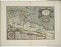 Map of Roman Africa and inset map of Carthage by Abraham Ortelius.jpeg 3,049 × 2,347; 2.31 MB
-
 Mauretania cesarea and tingitan10 A JC.jpg 296 × 170; 8 KB
-
 Mauretania et Numidia.jpg 3,509 × 1,383; 494 KB
-
 Roman provinces of North Africa.jpg 4,353 × 1,609; 1.56 MB
.jpg)


.jpg)

.jpg)

