Category:Maps of SG Uchte
Media in category "Maps of SG Uchte"
The following 22 files are in this category, out of 22 total.
-
 Karte SG Uchte Ortsteile.svg 1,500 × 1,641; 237 KB
-
 Karte SG Uchte-Bohnhorst.svg 1,500 × 1,641; 237 KB
-
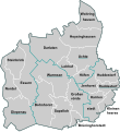
 Karte SG Uchte-Brüninghorstedt.svg 1,500 × 1,641; 237 KB
-
 Karte SG Uchte-Darlaten.svg 1,500 × 1,641; 237 KB
-
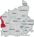
 Karte SG Uchte-Diepenau.svg 1,500 × 1,641; 237 KB
-
 Karte SG Uchte-Essern.svg 1,500 × 1,641; 237 KB
-
 Karte SG Uchte-Großenvörde.svg 1,500 × 1,641; 237 KB
-
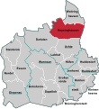
 Karte SG Uchte-Harrienstedt.svg 1,500 × 1,641; 237 KB
-
 Karte SG Uchte-Hoysinghausen.svg 1,500 × 1,641; 237 KB
-
 Karte SG Uchte-Huddestorf.svg 1,500 × 1,641; 237 KB
-
 Karte SG Uchte-Höfen.svg 1,500 × 1,641; 237 KB
-
 Karte SG Uchte-Jenhorst.svg 1,500 × 1,641; 237 KB
-
 Karte SG Uchte-Kleinenheerse.svg 1,500 × 1,641; 237 KB
-
 Karte SG Uchte-Lohhof.svg 1,500 × 1,641; 237 KB
-
 Karte SG Uchte-Nordel.svg 1,500 × 1,641; 237 KB
-
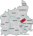
 Karte SG Uchte-Raddestorf.svg 1,500 × 1,641; 237 KB
-
 Karte SG Uchte-Sapelloh.svg 1,500 × 1,641; 237 KB
-
 Karte SG Uchte-Steinbrink.svg 1,500 × 1,641; 237 KB
-
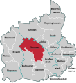
 Karte SG Uchte-Uchte.svg 1,500 × 1,641; 237 KB
-
 Karte SG Uchte-Warmsen.svg 1,500 × 1,641; 237 KB
-
 Karte SG Uchte-Woltringhausen.svg 1,500 × 1,641; 237 KB
-
 Uchte in NI.svg 1,591 × 1,602; 707 KB


