<nowiki>Category:Maps of Saare County; categoría de Wikimedia; kategori Wikimedia; Wikimedia category; د ويکيمېډيا وېشنيزه; Vikimedya kategorisi; ویکیمیڈیا زمرہ; kategória projektov Wikimedia; категорія проєкту Вікімедіа; 维基媒体分类; Wikimedia-Kategorie; Викимедиина категорија; Wikimedia-Kategorie; विकिपीडिया:श्रेणी; page de catégorie de Wikimedia; kategorija na Wikimediji; विकिपीडिया वर्ग; категорија на Викимедији; Wikimedia-Kategorie; Wikimedia-kategori; kategori Wikimédia; تصنيف ويكيميديا; pajenn rummata eus Wikimedia; Wikimedia:ကဏ္ဍခွဲခြင်း; 維基媒體分類; Wikimedia категориясы; categoría de Wikimedia; Wikimedia-Kategorie; Викимедиа категорияһы; tudalen categori Wikimedia; Viciméid catagóir; ردهٔ ویکیپدیا; 维基媒体分类; Wikimedia-kategori; ვიკიპედია:კატეგორიზაცია; ウィキメディアのカテゴリ; categoria Wikimedia; تصنيف بتاع ويكيميديا; විකිමීඩියා ප්රභේද පිටුව; categoria Vicimediorum; Vikipidiya:Shopni; Wikimedia-luokka; Wikimedia-categorie; விக்கிமீடியப் பகுப்பு; катэгорыя ў праекце Вікімэдыя; Викимедиа проектындагы төркем; catigurìa di nu pruggettu Wikimedia; หน้าหมวดหมู่วิกิมีเดีย; Wikimedia:Kategorija; Wikimedia-Kategorie; Wikimedia:Klassys; категория на Уикимедия; categorie a unui proiect Wikimedia; 維基媒體分類; Wikimedia-kategori; kawan Wikimèdia; гурӯҳи Викимедиа; 위키미디어 분류; Wikimedia-bólkur; kategorio en Vikimedio; kategori Wikimedia; categoría de Wikimedia; উইকিমিডিয়া বিষয়শ্রেণী; kategori Wikimedia; 维基媒体分类; וויקימעדיע קאַטעגאָריע; kategorija w projektach Wikimedije; thể loại Wikimedia; Wikimedia projekta kategorija; Wikimedia-kategorie; categoria de um projeto da Wikimedia; Wikimedia category; категорияд Ангилал; Wikimedia-kategori; kategori Wikimedia; پۆلی ویکیمیدیا; Wikimedia category; Vikimédia ñemohenda; Wikimédia-kategória; વિકિપીડિયા શ્રેણી; Wikimediako kategoria; категория в проекте Викимедиа; Wikimedia-Kategorie; Kategoriya ning Wikimedia; Wikimedia-kategorie; Wîkîmediya:Kategorî; विकिमिडिया श्रेणी; Wikimedia-Kategorie; קטגוריה במיזמי ויקימדיה; Викимедиа проектындагы төркем; categoria de Wikimedia; विकिमिडिया श्रेणी; κατηγορία εγχειρημάτων Wikimedia; Wikimedia-kategoriija; гурӯҳи Викимедиа; kategoria w projekcie Wikimedia; Wikimedia:Ronnaghys; Wikimedia-categorie; categoria di un progetto Wikimedia; kategori e Wikimedias; 维基媒体分类; categurìa 'e nu pruggette Wikimedia; Wikimedia kategooria; Wikimedia category; 維基媒體分類; kategorya ng Wikimedia; 維基媒體分類; ẹ̀ka Wikimedia; kategorie na projektech Wikimedia; categoria de um projeto da Wikimedia; kategorija na Wikimediji; Wikimedia-kategory; tumbung Wikimedia; kategoria ti Wikimedia; kategorija Wikimedije; Wikimedia proyektındağı törkem; Wikimedia-Kategorie; Wikimedia-categorie; kategori Wikimedia; jamii ya Wikimedia; വിക്കിമീഡിയ വർഗ്ഗം; 維基媒體分類; kategori Wikimedia; Վիքիմեդիայի նախագծի կատեգորիա; زمرو:وڪيپيڊيا زمرا بندي; विकिमीडिया श्रेणी; categoría de Wikimedia; guruhi Vikimedia; 维基媒体分类; катэгорыя ў праекце Вікімедыя</nowiki>
Subcategories
This category has the following 2 subcategories, out of 2 total.


 Atlas von Liefland 9.tif 1,404 × 1,024; 4.11 MB
 Counties of Saaremaa.jpg 4,710 × 4,138; 527 KB
 EE Saare outline.svg 766 × 790; 4.06 MB
 EE Saaremaa.PNG 600 × 545; 14 KB
 Eesti Saaremaa.png 657 × 436; 5 KB
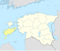 Estonia Saare locator map.svg 1,668 × 1,393; 629 KB
 Kesselaiu kaart.png 1,953 × 2,547; 685 KB
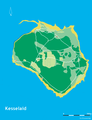 Map of Kesselaid.png 1,953 × 2,547; 652 KB
 Muhu.jpg 6,033 × 4,470; 894 KB
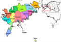 Osiliae municipia.PNG 640 × 438; 156 KB
 Saare County in Estonia.svg 1,666 × 1,391; 422 KB
 Saare in Estonia.svg 1,668 × 1,393; 751 KB
 Saare maakond.svg 884 × 636; 450 KB
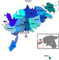 Saare municipalities 1992–1999.png 972 × 981; 81 KB
 Saare municipalities 1999–2014.png 972 × 981; 78 KB
 Saare municipalities 2014–2017.png 972 × 981; 74 KB
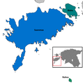 Saare municipalities 2017.png 972 × 981; 71 KB
 Saaremaa municipalities.png 287 × 296; 19 KB
 USSR map NO 34-6 Haapsalu.jpg 5,738 × 4,364; 6.39 MB


