Category:Maps of Sankt Andreasberg
Media in category "Maps of Sankt Andreasberg"
The following 11 files are in this category, out of 11 total.
-
 Detailkarte der Gräben in Sankt Andreasberg.jpg 6,438 × 4,293; 6.87 MB
-
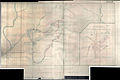
 Die Umgebung von St. Andreasberg in der 2. Hälfte des 17. Jahrhunderts.jpg 7,072 × 4,938; 6.47 MB
-

-

-

-
 Kleinbahn in St. Andreasberg Blatt 1.png 7,513 × 2,000; 26.01 MB
-
 Kleinbahn in St. Andreasberg Blatt 2.png 7,467 × 2,000; 24 MB
-
 Rehberger Graben.svg 1,000 × 1,959; 2.23 MB
-
 Sieberstollen und Grünhirscher Stollen.svg 1,250 × 793; 1.74 MB
-
 St. Andreasberger Kleinbahn.png 2,828 × 2,065; 1.3 MB
-
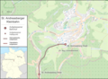
 St. Andreasberg–Braunlage.png 7,105 × 3,469; 41.9 MB


