Category:Maps of Schwetzingen
Media in category "Maps of Schwetzingen"
The following 10 files are in this category, out of 10 total.
-
 (Ghzgt. Baden) HEIDELBERG und SCHWETZINGEN.jpg 4,151 × 3,595; 8.01 MB
-
 Plan Schwetzingen (um 1840) sw.jpg 1,627 × 1,166; 916 KB
-
 Plan Schwetzingen (um 1840).jpg 1,627 × 1,166; 864 KB
-
 20120508Sternallee2.jpg 1,300 × 1,316; 486 KB
-
 Bruehl-1907.png 1,228 × 825; 1.98 MB
-

-
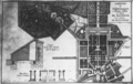
 Schwetzingen-Schloss-1762-03.png 908 × 929; 621 KB
-
 Schwetzingen-Schloss-1766.png 914 × 576; 413 KB
-
 Schwetzingen-Schloss-1836.png 1,010 × 930; 708 KB
-
 Waldsaum Langer Schlag N Hockenheim.png 1,162 × 662; 532 KB
_HEIDELBERG_und_SCHWETZINGEN.jpg)
_sw.jpg)
.jpg)


.jpg)


