Category:Maps of Second Schleswig War
Media in category "Maps of Second Schleswig War"
The following 24 files are in this category, out of 24 total.
-

-

-

-

-
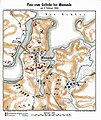
 Düppel Schlachtordnung Fontane 1866.jpg 882 × 503; 53 KB
-
 Düppel-Plan.jpg 5,425 × 6,545; 14.92 MB
-
 Düppel-Plan2.png 5,433 × 6,529; 61.27 MB
-
 Felttoget 1848 Mysunde.jpg 1,646 × 2,509; 1.21 MB
-
 Felttoget 1850 Mysunde.jpg 1,805 × 2,397; 1.46 MB
-
 IR 15 – Deutsch-dänischer Krieg.JPG 3,813 × 5,903; 9.65 MB
-
 Karte Deutsch-Dänischer Krieg Gebietsveränderungen.svg 1,860 × 2,227; 696 KB
-
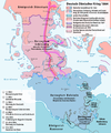 Karte Deutsch-Dänischer Krieg Militärereignisse.png 1,861 × 2,228; 708 KB
-
 Karte Deutsch-Dänischer Krieg no.svg 1,860 × 2,178; 389 KB
-
 Karte Deutsch-Dänischer Krieg.png 2,083 × 2,439; 348 KB
-
 Karte Düppeler Schanzen im Deutsch-Dänischen Krieg.png 1,000 × 1,171; 315 KB
-
 Kort 2. Slesvigske Krig Militære begivenheder.png 1,861 × 2,228; 713 KB
-
 Lagekarte der Düppeler Schanzen.png 1,800 × 1,524; 2.35 MB
-
 Meyers b5 s0232 b1.png 381 × 650; 179 KB
-
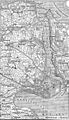
 Plan zum Gefecht bei Missunde 1864.jpg 758 × 900; 213 KB
-
 Schleswig-Holstein War Bul Map.png 5,241 × 4,500; 1.38 MB
-
 Situationskarte der Befestigungen von Düppel (1864).jpg 351 × 611; 96 KB
-
 Spruner-Menke Handatlas 1880 Karte 49.jpg 10,465 × 8,737; 24.39 MB
-

-

.jpg)
.jpg)
.jpg)
.jpg)


.jpg)

.jpg)
.jpg)