Category:Maps of Solway Firth
Media in category "Maps of Solway Firth"
The following 17 files are in this category, out of 17 total.
-
Admiralty Chart No 1826 Burrow Head to Liverpool, Published 1953.jpg 11,149 × 16,186; 58.6 MB
-
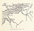
20 of 'Annals of the Solway until A.D. 1307. (With maps.)' (11251543894).jpg 2,496 × 1,848; 872 KB
-
29 of 'Annals of the Solway until A.D. 1307. (With maps.)' (11253618096).jpg 3,125 × 2,381; 1.22 MB
-
35 of 'Annals of the Solway until A.D. 1307. (With maps.)' (11251367724).jpg 1,752 × 1,618; 563 KB
-
41 of 'Annals of the Solway until A.D. 1307. (With maps.)' (11254205914).jpg 2,016 × 1,730; 597 KB
-
Admiralty Chart No 1346 Firth of Solway, Published 1844.jpg 9,919 × 6,765; 19.66 MB
-
Admiralty Chart No 1826 Formby Point to Kirkcudbright, Published 1893.jpg 11,316 × 18,307; 58.34 MB
-
Admiralty Chart No 1971 Firth of Solway to Loch Ryan, Published 1849.jpg 10,430 × 7,814; 18.8 MB
-
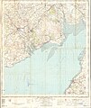
Ordnance Survey One-Inch Sheet 75 Dumfries and Gretna, Published 1965.jpg 8,232 × 9,879; 11.02 MB
-
Ordnance Survey One-Inch Sheet 75 Dumfries, Published 1947.jpg 10,910 × 12,758; 15.01 MB
-
Ordnance Survey One-Inch Sheet 81 Dalbeattie, Published 1956.jpg 8,388 × 9,954; 8.52 MB
-
Ordnance Survey One-Inch Sheet 81 Dalbeattie, Published 1963.jpg 10,937 × 13,121; 14.67 MB
-
Ordnance Survey Quarter-inch Sheet 8 Solway Firth, Published 1966.jpg 9,650 × 8,880; 9.72 MB


