Category:Maps of Strasbourg in the 18th century
Media in category "Maps of Strasbourg in the 18th century"
The following 12 files are in this category, out of 12 total.
-

-
 Argentina sub Germanis - btv1b102237066.jpg 5,559 × 3,858; 3.6 MB
-
 Carte ville et citadelle de Strasbourg (avant 1800).jpg 11,014 × 7,534; 23.14 MB
-
 Chorographia Argentorati Alsati metropolis.jpg 6,816 × 5,776; 11.02 MB
-
 Festung Kehl 1788.jpg 848 × 832; 541 KB
-
 Plan citadelle de Strasbourg (avant 1800).jpg 1,595 × 1,332; 725 KB
-

-
 Plan de la ville, et citadelle de Strasbourg, avec leurs environs - btv1b102239544.jpg 11,461 × 8,017; 14.85 MB
-

-
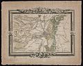
 Strasbourg 1706.jpg 1,023 × 404; 182 KB
-
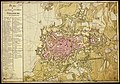
 Strasbourg1785.jpg 1,285 × 1,024; 317 KB
-
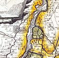
 Strasburg and the fortress of Kehl, 1734.jpg 1,276 × 1,071; 861 KB
.jpg)

.jpg)


.jpg)
_en_XII_cantons._Dress%C3%A9_et_grav%C3%A9_en_1790_pour_les_assembl%C3%A9es_de_la_Commune_par_sections._100_Toises_(%3D0m._032_;_1_-_6_000_env)._Grav%C3%A9_par_Weiss_-_btv1b84427147.jpg)


