Category:Maps of Strasbourg in the 19th century
Media in category "Maps of Strasbourg in the 19th century"
The following 21 files are in this category, out of 21 total.
-

-

-

-
 Bebauungsplan für die Erweiterung der Stadt Strassburg 1880.jpg 12,293 × 9,008; 17.49 MB
-
 Belagerung Straßburg 1870.jpg 1,536 × 2,188; 2.33 MB
-
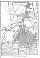
 Carte Strasbourg détail 01 Meyers Konversationslexikon 1888.jpg 1,700 × 1,725; 1.14 MB
-
 Carte Strasbourg extrait Meyers Konversationslexikon 1888.jpg 1,345 × 1,345; 1.3 MB
-
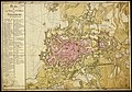
 Carte Strasbourg Meyers Konversationslexikon 1888.jpeg 2,634 × 1,760; 3.67 MB
-
 Gustave Fischbach-Strasbourg après le bombardement.jpg 1,024 × 743; 401 KB
-
 Karte Strassburg MK1888.png 2,634 × 1,760; 9.91 MB
-
 Meyers b15 s0371a.jpg 800 × 1,275; 334 KB
-
 Meyers b15 s0371b.jpg 800 × 546; 189 KB
-
 Meyers b6 s0189b.jpg 2,601 × 1,713; 4.7 MB
-
 Neudorf-plan-1895.jpg 13,038 × 10,556; 24.37 MB
-
 Plan de la ville, et citadelle de Strasbourg, avec leurs environs - btv1b102239544.jpg 11,461 × 8,017; 14.85 MB
-
 Plan dr Stadt Strassburg nach amtlichen Quellen bearbeitet - btv1b10223967w.jpg 11,340 × 7,638; 13.85 MB
-
 Plan Strasbourg projet Conrath 1880.png 1,400 × 900; 2.08 MB
-
 Plan topographique de la Ville de Strasbourg divisée en quatre Cantons.jpg 6,652 × 5,421; 9.16 MB
-
 Plan-zur-Belagerung-von-Strassburg.jpg 10,439 × 7,622; 10.13 MB
-
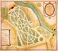 Strasbourg plan du parc du Contades XIXe siècle.jpg 1,566 × 1,359; 851 KB
-
 Vandernoot Plan de Strasbourg ce LV.25 mb.jpg 1,754 × 1,231; 495 KB
.jpg)
.jpg)
.jpg)


