Category:Maps of Suffolk County, New York
Counties of New York (state): Albany · Allegany · Bronx · Broome · Cattaraugus · Cayuga · Chautauqua · Chemung · Chenango · Clinton · Columbia · Cortland · Delaware · Dutchess · Erie · Essex · Franklin · Fulton · Genesee · Greene · Hamilton · Herkimer · Jefferson · Kings · Lewis · Livingston · Madison · Monroe · Montgomery · Nassau · New York · Niagara · Oneida · Onondaga · Ontario · Orange · Orleans · Oswego · Otsego · Putnam · Queens · Rensselaer · Richmond · Rockland · Saratoga · Schenectady · Schoharie · Schuyler · Seneca · St. Lawrence · Steuben · Suffolk · Sullivan · Tioga · Tompkins · Ulster · Warren · Washington · Wayne · Westchester · Wyoming · Yates
Wikimedia category | |||||
| Upload media | |||||
| Instance of | |||||
|---|---|---|---|---|---|
| Category combines topics | |||||
| Suffolk County | |||||
county in New York, United States   | |||||
| Instance of | |||||
| Named after | |||||
| Location | New York | ||||
| Located in or next to body of water | |||||
| Capital | |||||
| Inception |
| ||||
| Population |
| ||||
| Area |
| ||||
| Different from | |||||
| official website | |||||
 | |||||
Subcategories
This category has the following 17 subcategories, out of 17 total.
Media in category "Maps of Suffolk County, New York"
The following 22 files are in this category, out of 22 total.
-
 2022 New York's 1st Congressional District election map by precinct.svg 800 × 265; 1.74 MB
-

-
 Babylon Suffolk NY.png 1,069 × 823; 72 KB
-
 Brookhaven Suffolk NY.png 1,069 × 823; 72 KB
-
 E Hampton Suffolk NY.png 1,069 × 823; 72 KB
-
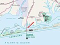
 Fire Isl-inlet Map.jpg 432 × 255; 37 KB
-
 Fire-island-map.jpg 3,493 × 1,382; 363 KB
-
 Huntington Suffolk NY.png 1,069 × 823; 72 KB
-
 Map of New York highlighting Suffok County Police District.png 250 × 191; 20 KB
-
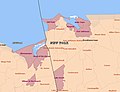
 Map of New York highlighting Suffolk County.png 300 × 232; 8 KB
-
 New York District 03 109th US Congress.png 657 × 406; 28 KB
-
 New York's 1st congressional district (new version) (since 2025).svg 1,600 × 1,069; 1.42 MB
-
 New York's 2nd congressional district (new version) (since 2025).svg 1,600 × 1,069; 1.91 MB
-
 NewYorkCongD1(2020).svg 800 × 450; 328 KB
-
 Part of Patchogue NYPL1633946.tiff 7,230 × 4,624; 95.65 MB
-
 New York State Senate District 1 (2012).png 3,330 × 2,574; 409 KB
-
 Smith Point Bridge map.jpg 890 × 668; 140 KB
-
 Stony Brook University CDP, 2020.jpg 846 × 652; 71 KB
-
 Suffolk County 1829.jpg 10,463 × 6,041; 6.69 MB
-
 Suffolk County Police District Precincts - w-NYS.png 1,478 × 857; 1,011 KB
-
 T1-1.jpg 13,107 × 7,207; 4.82 MB
-
 Texaco Terrazzo.jpg 4,896 × 3,264; 15.83 MB


_(since_2025).svg)
_(since_2025).svg)
.svg)
.png)


