Category:Maps of Suriname (territory claimed by Suriname)
Media in category "Maps of Suriname (territory claimed by Suriname)"
The following 182 files are in this category, out of 182 total.
-
 134 bevolkingsmeerderheid per ressort.png 1,281 × 920; 39 KB
-
 2020 Surinamese general election - Most voted party by district.svg 1,181 × 1,205; 328 KB
-
 2020 Surinamese general election - Results.svg 512 × 473; 268 KB
-
 2020 Zetels in DNA.jpg 2,200 × 2,544; 352 KB
-
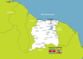
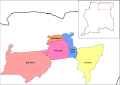
 All Districts.jpg 601 × 670; 74 KB
-
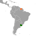
 Argentina Suriname Locator.svg 595 × 595; 752 KB
-
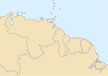
 Base Map of Suriname With Correct River Names.jpg 1,102 × 749; 299 KB
-
 Black Map shape Suriname with Flag.svg 1,062 × 1,085; 12 KB
-
 Borders of Suriname - Grenzen van Suriname.svg 842 × 1,032; 371 KB
-
 Brazil Suriname Locator with Correct Borders.png 768 × 712; 16 KB
-
 Brazil Suriname Locator.svg 595 × 595; 769 KB
-
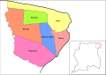
 Brokopondo resorts.svg 842 × 595; 301 KB
-
 Colombia Suriname Locator.svg 595 × 595; 732 KB
-
 Commewijne resorts.svg 842 × 595; 219 KB
-
 Correct map of Suriname With District Names.jpg 2,310 × 2,593; 334 KB
-
 District Sipaliwini in Suriname.svg 1,181 × 1,205; 262 KB
-
 Districten kaart van Suriname.svg 842 × 1,108; 1.42 MB
-
 Districts of Suriname.png 3,507 × 4,960; 220 KB
-
 Divisão Política do Suriname correcta.png 2,370 × 2,336; 464 KB
-
 Divisão Política do Suriname Corrected.png 2,271 × 2,241; 258 KB
-
 Ecuador Suriname Locator.svg 595 × 595; 720 KB
-
 Falkland Islands Suriname Locator.svg 595 × 595; 711 KB
-
 Flag Map of Dutch Suriname 1954 -1975.png 2,558 × 2,658; 188 KB
-
 Flag Map of Suriname.svg 827 × 791; 44 KB
-
 Flag-map of Suriname.png 529 × 484; 17 KB
-
 French Guiana Suriname Locator.svg 595 × 595; 709 KB
-
 Geologische kaart van Suriname.png 2,385 × 3,339; 1.57 MB
-
 Green Map of Suriname with Districts and Capitals per district.png 2,226 × 2,373; 235 KB
-
 Guyana Suriname Locator.svg 595 × 595; 715 KB
-
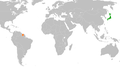 Japan Suriname Locator Corrected.png 1,958 × 1,096; 281 KB
-
 Kaart van Boven-Corantijn en Corantijn Rivier - Suriname.svg 842 × 1,032; 361 KB
-
 Kaart van Coeroeni Rivier - Suriname.svg 842 × 1,032; 345 KB
-
 Kaart van Coeroeni-Kutari-Sipaliwini Rivier - Suriname.svg 842 × 1,032; 293 KB
-
 Kaart van Commewijne - Cottica Rivier - Suriname.svg 842 × 1,032; 313 KB
-
 Kaart van Coppename-Linker- en Rechter Coppename Rivier - Suriname.svg 842 × 1,032; 329 KB
-
 Kaart van Kabalebo Rivier - Suriname.svg 842 × 1,032; 339 KB
-
 Kaart van Kutari Rivier - Suriname.svg 842 × 1,032; 343 KB
-
 Kaart van Litani Rivier - Suriname.svg 842 × 1,032; 298 KB
-
 Kaart van Lucie Rivier - Suriname.svg 842 × 1,032; 341 KB
-
 Kaart van Marowini - Lawa - Marowijne Rivier - Suriname.svg 842 × 1,032; 304 KB
-
 Kaart van Nickerie Rivier - Suriname.svg 842 × 1,032; 336 KB
-
 Kaart van Oelemarie Rivier - Suriname.svg 842 × 1,032; 296 KB
-
 Kaart van Oronoque Rivier - Suriname.svg 842 × 1,032; 351 KB
-
 Kaart van Palumeu Rivier - Suriname.svg 842 × 1,032; 292 KB
-
 Kaart van Saramacca en Kleine Saramacca Rivier - Suriname.svg 842 × 1,032; 322 KB
-
 Kaart van Sipaliwini Rivier - Suriname.svg 842 × 1,032; 343 KB
-
 Kaart van Suriname (Grenzen,Rivieren,Wegen,Plaatsen).png 5,952 × 6,632; 1.76 MB
-
 Kaart van Suriname - Map of Suriname.png 8,417 × 5,952; 1.9 MB
-
 Kaart van Suriname-Gran Rio- Pikin Rio en Van Blommensteinmeer - Suriname.svg 842 × 1,032; 317 KB
-
 Kaart van Suriname.png 300 × 300; 198 KB
-
 Kaart van Tapanahony Rivier - Suriname.svg 842 × 1,032; 290 KB
-
 Kaartsuriname 2.gif 487 × 481; 71 KB
-
 Koppen-Geiger Map SURINAME present.svg 512 × 371; 377 KB
-
 LGBT flag map of Suriname.png 2,558 × 2,658; 109 KB
-
 Location Suriname.jpg 250 × 115; 9 KB
-
 Location Suriname.svg 1,000 × 500; 341 KB
-
 Location-Suriname.png 250 × 115; 7 KB
-
 Map of Suriname - Army Green.png 3,000 × 3,000; 181 KB
-
 Map of Suriname - Athletic Gold.png 3,000 × 3,000; 188 KB
-
 Map of Suriname - Black.png 3,000 × 3,000; 113 KB
-
 Map of Suriname - Blue.png 3,000 × 3,000; 177 KB
-
 Map of Suriname - Brokopondo Highlight.png 2,310 × 2,593; 206 KB
-
 Map of Suriname - Brown.png 3,000 × 3,000; 182 KB
-
 Map of Suriname - Burgundy.png 3,000 × 3,000; 183 KB
-
 Map of Suriname - Charcoal Grey.png 3,000 × 3,000; 189 KB
-
 Map of Suriname - Commewijne Highlight.png 2,310 × 2,593; 211 KB
-
 Map of Suriname - Coronie Highlight.png 2,310 × 2,593; 211 KB
-
 Map of Suriname - Corrected.jpg 640 × 320; 80 KB
-
 Map of Suriname - Forest Green.png 3,000 × 3,000; 179 KB
-
 Map of Suriname - Green.png 3,000 × 3,000; 175 KB
-
 Map of Suriname - Grey.png 3,000 × 3,000; 191 KB
-
 Map of Suriname - Hot Pink.png 3,000 × 3,000; 188 KB
-
 Map of Suriname - Marowijne Highlight.png 2,310 × 2,593; 212 KB
-
 Map of Suriname - Metallic Gold.png 3,000 × 3,000; 194 KB
-
 Map of Suriname - Metallic Silver.png 3,000 × 3,000; 196 KB
-
 Map of Suriname - Navy Blue.png 3,000 × 3,000; 177 KB
-
 Map of Suriname - Nickerie Highlight.png 2,310 × 2,593; 214 KB
-
 Map of Suriname - Orange.png 3,000 × 3,000; 176 KB
-
 Map of Suriname - Para Highlight.png 2,310 × 2,593; 210 KB
-
 Map of Suriname - Paramaribo Highlight.png 2,310 × 2,593; 216 KB
-
 Map of Suriname - Purple.png 3,000 × 3,000; 188 KB
-
 Map of Suriname - Red.png 3,000 × 3,000; 183 KB
-
 Map of Suriname - Reflex Blue.png 3,000 × 3,000; 179 KB
-
 Map of Suriname - Saramacca Highlight.png 2,310 × 2,593; 211 KB
-
 Map of Suriname - Sipaliwini Highlight.png 2,310 × 2,593; 192 KB
-
 Map of Suriname - Teal.png 3,000 × 3,000; 177 KB
-
 Map of Suriname - Wanica Highlight.png 2,310 × 2,593; 212 KB
-
 Map of Suriname - White.png 3,000 × 3,000; 188 KB
-
 Map of Suriname - Yellow.png 3,000 × 3,000; 181 KB
-
 Map of Suriname Black Fill and Golden District Borders.svg 842 × 1,190; 220 KB
-
 Map of Suriname Black Shadow.jpg 2,480 × 2,459; 191 KB
-
 Map of Suriname Blue Shadow.jpg 2,480 × 2,459; 343 KB
-
 Map of Suriname Green Shadow.jpg 2,480 × 2,459; 349 KB
-
 Map of Suriname Grey Shadow.jpg 2,480 × 2,459; 246 KB
-
 Map of Suriname Orange Shadow.jpg 2,480 × 2,459; 363 KB
-
 Map of Suriname Pink Shadow.jpg 2,480 × 2,459; 355 KB
-
 Map of Suriname Red Shadow.jpg 2,480 × 2,459; 351 KB
-
 Map of Suriname White Shadow.jpg 2,480 × 2,459; 255 KB
-
 Map of Suriname with Borders as claimed by Suriname and Venezuela.png 1,558 × 1,676; 563 KB
-
 Map of Suriname with Coat of Arms and Flag.svg 841 × 595; 390 KB
-
 Map of Suriname with Correct border Rivers and place names.png 1,603 × 1,744; 571 KB
-
 Map of Suriname with Neighboring countries.png 8,946 × 5,840; 1.01 MB
-
 Map of Suriname with Place Names.png 3,507 × 2,480; 574 KB
-
 Map of Suriname Yellow Shadow.jpg 2,480 × 2,459; 324 KB
-
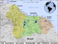 Map of the Guianas - Guyana, Suriname and French Guiana.png 2,400 × 1,800; 2.5 MB
-
 Map of the Guianas Neutral.svg 842 × 595; 213 KB
-
 Map of Tigri Area Suriname.png 2,523 × 1,785; 3.35 MB
-
 Marowijne resorts.svg 842 × 595; 336 KB
-
 Nickerie Resorts.svg 842 × 595; 374 KB
-
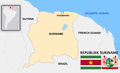 Official borders of the Republic of Suriname 2.png 2,800 × 1,700; 456 KB
-
 Official borders of the Republic of Suriname.png 3,280 × 2,168; 573 KB
-
 Orthographic map of Suriname Showing the Correct Borders.png 2,292 × 2,292; 708 KB
-
 Orthographic suriname.jpg 547 × 539; 67 KB
-
 Overview map of Suriname.png 2,270 × 2,322; 233 KB
-
 Para resorts.svg 842 × 595; 275 KB
-
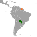 Paraguay Suriname Locator.svg 595 × 595; 715 KB
-
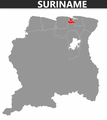
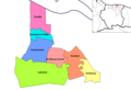
 Paramaribo Suriname Ressorts 2023.png 1,056 × 816; 27 KB
-
 Peru Suriname Locator.svg 595 × 595; 730 KB
-
 Real - Correct Map of Suriname - White with Coat of Arms and Shadow.jpg 2,480 × 2,459; 837 KB
-
 Real - Correct Map of Suriname - White with Coat of Arms without Shadow.jpg 2,480 × 2,459; 806 KB
-
 Real - Correct Map of Suriname 50 % Transparency.jpg 2,480 × 2,459; 665 KB
-
 Real - Correct Map of Suriname Coat of arms and flag.jpg 2,480 × 2,459; 972 KB
-
 Real - Correct Map of Suriname Coat of Arms with Flag.jpg 2,480 × 2,459; 845 KB
-
 Real - Correct Map of Suriname Coat of Arms with Transparent Flag.jpg 2,480 × 2,459; 925 KB
-
 Real Flag-map of Suriname.svg 400 × 366; 95 KB
-
 Real Map of Suriname showing the Correct Borders.png 4,167 × 4,167; 275 KB
-
 Rivers of Suriname.png 4,000 × 4,332; 971 KB
-
 Saramacca Resorts.svg 842 × 595; 305 KB
-
 Sipaliwini Resorts.svg 842 × 595; 1.43 MB
-
 Surinaamse districten 1966-1985.jpg 4,128 × 3,096; 3.62 MB
-
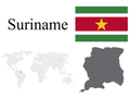
 Flag Map of Suriname.png 481 × 479; 5 KB
-
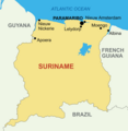
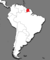
 Suriname - Location Map (2022) - SUR.png 800 × 800; 244 KB
-
 Suriname administrative divisions - ukr -.png 4,924 × 5,023; 1.11 MB
-
 Suriname administrative divisions with Correct River Names.png 4,924 × 5,023; 1.21 MB
-
 Suriname border rivers true names.png 5,656 × 4,000; 1.09 MB
-
 Suriname Border, River and Road Network.svg 992 × 850; 460 KB
-
 Suriname District Numbers.svg 595 × 612; 198 KB
-
 Suriname districts blank.svg 595 × 558; 154 KB
-
 Suriname Flag, Map and Locator.png 4,000 × 3,000; 585 KB
-
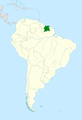
 Suriname Highlighted on Map of South America.png 3,905 × 4,697; 901 KB
-
 Suriname Highlighted on the Map of South America.png 4,921 × 7,217; 1.34 MB
-
 Suriname in South America Corrected.png 1,100 × 1,432; 37 KB
-

-
 Suriname Location Map with Flag.svg 949 × 842; 782 KB
-
 Suriname Location on World Map.png 7,560 × 3,571; 823 KB
-
 Suriname Locator - South America.png 4,167 × 4,167; 6.72 MB
-
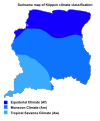 Suriname map of Köppen climate classification Correct.svg 3,000 × 3,604; 61 KB
-
 Suriname Map Shape Black and White.svg 1,814 × 1,100; 22 KB
-
 Suriname Map Shape with Capital Paramaribo.png 3,000 × 3,000; 359 KB
-
 Suriname Map With Flag.svg 850 × 850; 611 KB
-
 Suriname map.png 370 × 357; 31 KB
-
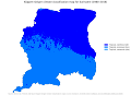
 Suriname Population Density 2012.svg 1,182 × 1,223; 228 KB
-
 Suriname Resorts Updated.svg 822 × 832; 324 KB
-
 Suriname River Map.png 6,000 × 4,242; 39.19 MB
-
 Suriname Shape with Blue Background.svg 567 × 567; 57 KB
-
 Suriname Simple Map 1.svg 842 × 947; 233 KB
-
 Suriname Simple Map 2.svg 842 × 947; 317 KB
-
 Suriname Switzerland Locator Corrected.png 1,464 × 1,216; 53 KB
-
 Suriname Territorial Integrity.png 2,000 × 1,333; 1.6 MB
-
 Suriname With Districts - Blanc.jpg 2,310 × 2,593; 318 KB
-
 Flag map of Greater Suriname.png 1,749 × 1,813; 54 KB
-
 Suriname-Brokopondo.svg 595 × 558; 154 KB
-
 Suriname-Commewijne.svg 595 × 558; 154 KB
-
 Suriname-Coronie.svg 595 × 558; 154 KB
-
 Suriname-Marowijne.svg 595 × 558; 154 KB
-
 Suriname-Nickerie.svg 595 × 558; 154 KB
-
 Suriname-Oppervlakte per district - Area per district in km2.svg 842 × 972; 441 KB
-
 Suriname-Para.svg 595 × 558; 154 KB
-
 Suriname-Paramaribo.svg 595 × 558; 154 KB
-
 Suriname-Saramacca.svg 595 × 558; 154 KB
-
 Suriname-Sipaliwini.svg 595 × 558; 154 KB
-
 Suriname-Wanica.svg 595 × 558; 154 KB
-
 Telesur Suriname 4G Coverage Map 2021.png 1,181 × 1,205; 577 KB
-
 The 10 Districts of Suriname - De 10 districten van Suriname.svg 595 × 612; 304 KB
-
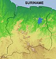
 Topografisch Kaart van Suriname.jpg 800 × 855; 764 KB
-
 Topographic Border Map Suriname.jpg 2,480 × 2,580; 4.36 MB
-
 Topographic Map of Suriname.png 910 × 927; 1.59 MB
-
 Tribal communities Suriname.png 1,886 × 1,628; 1.35 MB
-
 Uruguay Suriname Locator.svg 595 × 595; 709 KB
-
 Venezuela Suriname Locator.svg 595 × 595; 730 KB
-
 Wanica resorts.png 955 × 654; 14 KB
-
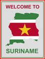 Welcome to Suriname Card.png 1,840 × 2,436; 92 KB


.png)


_-_SUR.png)


