Category:Maps of Syrtis Major quadrangle
Media in category "Maps of Syrtis Major quadrangle"
The following 14 files are in this category, out of 14 total.
-
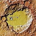
 Antoniadi crater on Mars.png 970 × 1,120; 1.62 MB
-
 Arabia Terra Elevation ESA218942.jpg 2,500 × 1,371; 1.86 MB
-
 FlammarionMartianCrater.jpg 702 × 672; 86 KB
-
 Jezero crater — the landing site for NASA’s Mars 2020 mission.png 3,276 × 2,300; 1.53 MB
-
 NASA-Mars-JezeroCrater-20181116.jpg 3,300 × 2,550; 2.99 MB
-
 Nili Fossae topography (16340200245).jpg 8,267 × 3,600; 4.42 MB
-
 Sim3464 USGS Jezero Crater.png 6,060 × 6,756; 13.9 MB
-
 Sim3464 USGS Sedona Crater.png 2,500 × 2,088; 2.5 MB
-
 TeisserencMartianCrater.jpg 660 × 662; 108 KB
-
 Topographic map of Jezero crater and surrounds (annotated) ESA23162625.jpeg 26,264 × 22,223; 44.44 MB
-
 Topography of Nili Fossae ESA412211.tiff 7,829 × 3,600; 57.74 MB
-
 USGS-Mars-MC-13-JezeroCrater.png 864 × 738; 1.16 MB
-
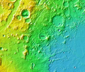
 USGS-Mars-MC-13-SyrtisMajorRegion-mola.png 2,499 × 1,999; 5.94 MB
-
 Windstreaks (PIA25942).png 201 × 338; 139 KB


.jpg)


_ESA23162625.jpeg)


.png)