Category:Maps of Temeşvar Province, Ottoman Empire
Media in category "Maps of Temeşvar Province, Ottoman Empire"
The following 28 files are in this category, out of 28 total.
-
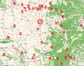
 Temescher Banat BV044703808.jpg 9,531 × 10,405; 11.71 MB
-
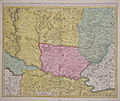 Banat1700.jpg 737 × 623; 157 KB
-
 Central europe 1572 hu.svg 922 × 880; 117 KB
-
 Central europe 1572.png 922 × 880; 120 KB
-
 Central Erope 1572 es.svg 1,122 × 883; 248 KB
-
 Central Erope 1572 HU.svg 1,122 × 883; 243 KB
-
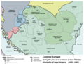 Central europe 1683.png 1,280 × 971; 406 KB
-
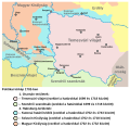
 Vassal states of the Ottoman Empire in 1683 hu.svg 877 × 688; 397 KB
-
 Vassal states of the Ottoman Empire in 1683.svg 877 × 688; 278 KB
-
 Vassal states of the Ottoman Empire in 1683-es.svg 2,557 × 2,000; 1.11 MB
-
 Vassal states of the Ottoman Empire in 1683-pt.svg 2,557 × 2,000; 583 KB
-
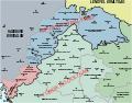
 Temesvar Eyalet, Central europe 1683.png 1,499 × 974; 788 KB
-
 Cetati Banat.png 1,280 × 1,000; 1.34 MB
-
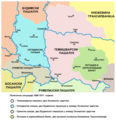 Ottoman vojvodina01-sr.png 944 × 978; 92 KB
-
 Ottoman vojvodina01.png 944 × 978; 107 KB
-
 Elayet of temesvar-sr.png 833 × 1,075; 109 KB
-
 Elayet of temesvar.png 833 × 1,075; 123 KB
-
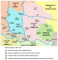
 Eyalet of temesvar1699 hu.svg 1,347 × 1,312; 90 KB
-
 Eyalet of temesvar1699-sr.png 1,010 × 984; 101 KB
-
 Eyalet of temesvar1699.png 1,010 × 984; 113 KB
-

-
 Ottoman vojvodina ethnicity religion-sr.png 1,122 × 1,272; 90 KB
-
 Ottoman vojvodina ethnicity religion.png 1,122 × 1,272; 128 KB
-
 Srbsko Ottoman-es.svg 838 × 1,093; 243 KB
-
 Srbsko Ottoman.svg 785 × 1,024; 123 KB
-
 Szerbia az Oszmán Birodalom idején.svg 785 × 1,024; 123 KB
-
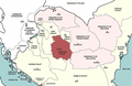
 Temesvar Eyalet, Ottoman Empire (1609).png 1,600 × 1,250; 1.27 MB
-
 Temeşvar Eyalet, Ottoman Empire (1609)-ar.png 1,600 × 1,250; 1.54 MB


.png)
-ar.png)