Category:Maps of Texcoco Lake, Mexico
Media in category "Maps of Texcoco Lake, Mexico"
The following 34 files are in this category, out of 34 total.
-
 1754 Bellin Map of Mexico City ^ Environs - Geographicus - MexicoCity2-bellin-1754.jpg 2,095 × 2,508; 1.03 MB
-

-
 A Mexikói-völgy 1519-ben.png 1,330 × 1,794; 1.25 MB
-
 Anales del Instituto Geológico de México (1917) (17980315060).jpg 3,253 × 3,120; 827 KB
-
 Basin of Mexico 1519 map-en.svg 1,412 × 1,883; 526 KB
-
 Basin of Mexico 1519 map-es.svg 1,412 × 1,883; 526 KB
-
 Basin of Mexico 1519 map-fr.svg 1,412 × 1,883; 528 KB
-
 Basin of Mexico 1519 map-pt.svg 1,412 × 1,883; 509 KB
-
 Basin of Mexico 1519 map-zh-cn.svg 1,412 × 1,883; 526 KB
-
 CGF DF M5 V4 0268.jpg 1,032 × 1,329; 292 KB
-
 Chalcolake.png 444 × 599; 268 KB
-
 Ciudad de México y Lago de Texcoco.png 929 × 864; 253 KB
-
 Cuenca de M.png 1,440 × 1,906; 2.79 MB
-
 Cuenca del valle.png 448 × 594; 442 KB
-
 Dique Nezahualcóyotl primer mapa de Tenochtitlan.png 4,100 × 1,224; 12.83 MB
-

-
 Karte des Thales von Mexico.jpeg 1,421 × 1,242; 538 KB
-
 Lago de Texcoco-descriptivo.png 778 × 1,017; 296 KB
-
 Lago de Texcoco-posclásico.png 1,412 × 1,644; 336 KB
-
 Lago de Texcoco.jpg 647 × 496; 122 KB
-
 Lake Chalco 1847.PNG 447 × 517; 600 KB
-
 Lake Texcoco c 1519.png 1,330 × 1,794; 1.64 MB
-
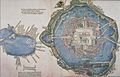
 Tenochtitlan-medium.png 2,296 × 2,432; 4.54 MB
-
 Map of Tenochtitlan, 1524.jpg 3,029 × 1,931; 4.99 MB
-
-
 Mexico, California and Arizona - 1900 - Environs of Mexico.jpg 1,859 × 2,856; 2.5 MB
-

-
 Ruta de escape de los españoles hacia Tlaxcala.svg 989 × 740; 1.31 MB
-
 Tenochtitlan.jpg 1,179 × 2,061; 326 KB
-

-

-

-
 Valley of Mexico c.1519-fr.svg 731 × 849; 250 KB
-
 Xochi.pdf 1,239 × 1,754, 2 pages; 86 KB

%27_(11115283673).jpg)

_(17980315060).jpg)


_December_1855_map_from_Harper%27s_New_Monthly_Magazine_Volume_12_December_1855_to_May_1856_(IA_harpersnew12harper)_(page_34_crop).jpg)


_(14760035076).jpg)

_(14595125509).jpg)


_(14576056538).jpg)
.jpg)
.jpg)
