Category:Maps of Thailand during World War II
Media in category "Maps of Thailand during World War II"
The following 14 files are in this category, out of 14 total.
-
 Burma Front Map.png 1,000 × 1,445; 436 KB
-
 Death Railway.png 1,000 × 1,300; 530 KB
-
 French Indochina subdivisions ww2-es.svg 667 × 1,017; 547 KB
-
 French Indochina subdivisions ww2.svg 667 × 1,017; 81 KB
-
 Japanese Invasion of Thailand 8 Dec 1941.png 548 × 800; 43 KB
-
 Kingdom of Thailand in World War II map.png 330 × 715; 72 KB
-
 Kingdom of Thailand World War II orthographic map.png 541 × 541; 112 KB
-
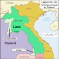 Laos 1941-46.png 1,003 × 996; 162 KB
-
 Pacific War - Southern Asia 1942 - Map.jpg 1,260 × 961; 183 KB
-
 Provinces of Cambodia loss to Thailand during Franco-Thai War Km.png 1,200 × 900; 4.14 MB
-
 Provinces of Cambodia loss to Thailand during Franco-Thai War.png 1,200 × 900; 187 KB
-
 Saharat Thai Doem map.png 962 × 870; 189 KB
-
 Sirat Malai and Malaya.png 549 × 627; 57 KB
-
 State of Thailand map.png 621 × 344; 49 KB


