Category:Maps of Torrevieja
Media in category "Maps of Torrevieja"
The following 9 files are in this category, out of 9 total.
-
 Localització de Torrevella respecte el Baix Segura.png 400 × 400; 44 KB
-
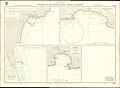 Admiralty Chart No 1544 Ports on the South East Coast of Spain, Published 1968.jpg 11,280 × 8,298; 22.16 MB
-
 Karte Gemeinde Torrevieja 2022.png 5,000 × 5,185; 1.85 MB
-
 Localització de Torrevella respecte al País Valencià.png 238 × 400; 28 KB
-
 Localización de Torrevieja - Alicante.svg 387 × 397; 229 KB
-
 MTN25-0914c4-2003-La Mata.jpg 7,726 × 5,453; 6.73 MB
-
 MTN25-0914c4-2012-La Mata.jpg 7,874 × 5,160; 9.14 MB
-
 MTN25-0935c2-2004-Torrevieja.jpg 7,726 × 5,425; 5.95 MB
-
 Torrevieja-Mapa de la Vega Baja del Segura.svg 595 × 595; 376 KB


