Category:Maps of Town of Smithtown, New York
Use the appropriate category for maps showing all or a large part of Smithtown. See subcategories for smaller areas:
| If the map shows | Category to use |
|---|---|
| Smithtown on a recently created map | Category:Maps of Town of Smithtown, New York or its subcategories |
| Smithtown on a map created more than 70 years ago | Category:Old maps of Town of Smithtown, New York or its subcategories |
| the history of Smithtown on a recently created map | Category:Maps of the history of Town of Smithtown, New York or its subcategories |
| the history of Smithtown on a map created more than 70 years ago | Category:Old maps of the history of Town of Smithtown, New York or its subcategories |
Media in category "Maps of Town of Smithtown, New York"
The following 33 files are in this category, out of 33 total.
-
-
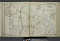
 Centerport; Smith Town NYPL1633978.tiff 7,230 × 4,960; 102.6 MB
-
 Commack-map.png 575 × 425; 50 KB
-
 Fort-salonga-map.gif 575 × 425; 49 KB
-
 Hauppauge-ny-map.gif 575 × 425; 71 KB
-
 Head-harbor-ny-map.gif 575 × 425; 66 KB
-

-
 Kings-park-map.gif 575 × 425; 58 KB
-
 Lake-ronkonkoma-map.gif 575 × 425; 73 KB
-
 Nesconset map.gif 422 × 359; 15 KB
-
 Nesconset-map.gif 575 × 425; 74 KB
-
 Nissequogue-map.gif 575 × 425; 53 KB
-
 Part of Smith Town Suffolk County NYPL1633967.tiff 7,230 × 4,960; 102.6 MB
-
 Part of Smith Town Suffolk County NYPL1633968.tiff 7,230 × 4,960; 102.6 MB
-

-

-

-

-

-

-
 Smith Town Branch NYPL1633982.tiff 7,230 × 4,960; 102.6 MB
-
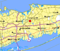
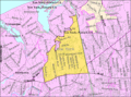
 Smithtown-town-map.gif 575 × 425; 70 KB
-
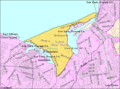
 Smithtown-village-map.gif 575 × 425; 71 KB
-
 Smithtown-village-map.PNG 581 × 430; 111 KB
-

-
 St-james-ny-map.gif 575 × 425; 72 KB
-
 Suffolk County, NY, towns and villages Head of the Harbor highlighted.svg 950 × 543; 1.36 MB
-
 Suffolk County, NY, towns and villages Town of Smithtown highlighted.svg 963 × 615; 2.15 MB
-
 Suffolk County, NY, towns and villages Village of the Branch highlighted.svg 963 × 615; 2.15 MB
-

-

-
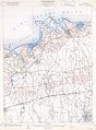
 T42-li.jpg 7,646 × 11,318; 3.36 MB
-
 Village-branch-map.gif 575 × 425; 55 KB
_-_Geographicus_-_Setauket-uscs-1925.jpg)


_-_with_other_ancient_documents_of_historic_value_(1898)_(14591196930).jpg)
_-_with_other_ancient_documents_of_historic_value_(1898)_(14591238969).jpg)
_-_with_other_ancient_documents_of_historic_value_(1898)_(14777513312).jpg)
_-_with_other_ancient_documents_of_historic_value_(1898)_(14777555902).jpg)
_-_with_other_ancient_documents_of_historic_value_(1898)_(14797734333).jpg)


_-_with_other_ancient_documents_of_historic_value_(1898)_(14591450687).jpg)