Category:Maps of Turku
Subcategories
This category has the following 3 subcategories, out of 3 total.
L
O
P
Media in category "Maps of Turku"
The following 32 files are in this category, out of 32 total.
-
 18-08-2017 Turku attack map.jpg 1,272 × 857; 342 KB
-
 Districts of Turku 2012.png 1,108 × 1,503; 337 KB
-
 Districts of Turku 2017.jpg 1,618 × 2,538; 654 KB
-
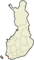
 Location of Turku in Finland.png 230 × 400; 6 KB
-
 LocationTurku.png 250 × 115; 9 KB
-
 Maaria.sijainti.svg 1,750 × 2,950; 1.14 MB
-
 Major factories in Turku in the 1900s.jpg 6,928 × 6,100; 2.55 MB
-
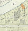 Museon alueen tontit Tillbergin kartalla, tontti 14.jpg 3,874 × 4,299; 836 KB
-
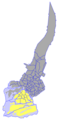
 Paattinen.sijainti.svg 1,850 × 3,220; 249 KB
-
 Passenger terminals at Turku airport 001.png 1,154 × 744; 82 KB
-
 Rekisterikylät - Maaria ja Turku (1968).png 3,195 × 3,997; 832 KB
-
 Turku dot.png 1,804 × 3,002; 284 KB
-
 Turku Finland street map.svg 5,337 × 5,028; 10.19 MB
-
 Turku Karte.png 230 × 400; 6 KB
-
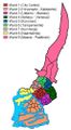 Turku wards.jpg 275 × 500; 41 KB
-
 Turku, Hirvensalo-Kakskerta.png 1,433 × 2,913; 51 KB
-
 Turku, Itäharju-Varissuo.png 1,433 × 2,913; 50 KB
-
 Turku, Keskusta.png 1,433 × 2,913; 50 KB
-
 Turku, Koroinen (ward).png 1,433 × 2,913; 50 KB
-
 Turku, Kuninkoja.png 1,433 × 2,913; 50 KB
-
 Turku, Maaria-Paattinen.png 1,433 × 2,913; 50 KB
-
 Turku, Naantalintie.png 1,433 × 2,913; 50 KB
-
 Turku, Tampereentie.png 1,433 × 2,913; 50 KB
-
 Turku, Uittamo-Skanssi.png 1,433 × 2,913; 50 KB
-
 Turku, VII streetmap.png 630 × 579; 203 KB
-
 Turku.alueliitokset.1930-1988.svg 800 × 1,400; 98 KB
-
 Turku.sijainti.suomi.2007.svg 1,850 × 3,220; 269 KB
-
 Turku.sijainti.suomi.2008.svg 1,850 × 3,220; 269 KB
-
 Turun ja Kaarinan seurakunnat.svg 300 × 450; 28 KB
-
 Turun kaupunkiseutu 2013.png 1,301 × 811; 110 KB
-
 Turun kaupunkiseutu.PNG 776 × 609; 60 KB
-
 Turun urheilupuisto (Turku Sports Park).PNG 831 × 1,209; 156 KB


.png)


.png)


.PNG)