Category:Maps of Vestmannaeyjar (volcanic system)
Subcategories
This category has the following 3 subcategories, out of 3 total.
Media in category "Maps of Vestmannaeyjar (volcanic system)"
The following 2 files are in this category, out of 2 total.
-
 Vestmann archipel topographic map-fr.svg 887 × 738; 323 KB
-
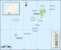
 Vestmannaeyjar archipelago topographic map-en.svg 512 × 426; 142 KB

