Category:Maps of Victorian Legislative Council electoral provinces
Media in category "Maps of Victorian Legislative Council electoral provinces"
The following 8 files are in this category, out of 8 total.
-

-
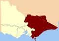 Eastern Province 1856.png 400 × 279; 11 KB
-
 North-Western Province 1856.png 400 × 279; 11 KB
-
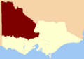
 South Province 1856.png 400 × 279; 10 KB
-
 South-West Province 1856.png 400 × 279; 11 KB
-
 Victoria State Election 2014 (Simple Map).svg 3,452 × 3,128; 386 KB
-
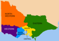 Victorian Legislative Council provinces 1856.png 400 × 279; 15 KB
-
 Western Province 1856.png 400 × 279; 11 KB


.svg)

