Category:Maps of Victorian Legislative Council electoral regions
Media in category "Maps of Victorian Legislative Council electoral regions"
The following 18 files are in this category, out of 18 total.
-
 Regions of the Victorian Legislative Council (2022).svg 800 × 600; 3.78 MB
-
 VIC Eastern Metropolitan Region 2014.png 800 × 514; 34 KB
-
 VIC Eastern Victoria Region 2014.png 800 × 514; 35 KB
-
 VIC Eastern Victoria Region 2022.svg 800 × 568; 7.3 MB
-
 VIC North-Eastern Metropolitan Region 2022.svg 800 × 568; 7.3 MB
-
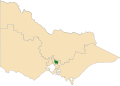
 VIC Northern Metropolitan Region 2014.png 800 × 514; 34 KB
-
 VIC Northern Metropolitan Region 2022.svg 800 × 568; 7.3 MB
-
 VIC Northern Victoria Region 2014.png 800 × 514; 34 KB
-
 VIC Northern Victoria Region 2022.svg 800 × 568; 7.3 MB
-
 VIC South-Eastern Metropolitan Region 2014.png 800 × 514; 34 KB
-
 VIC South-Eastern Metropolitan Region 2022.svg 800 × 568; 7.3 MB
-
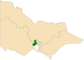
 VIC Southern Metropolitan Region 2014.png 800 × 514; 34 KB
-
 VIC Southern Metropolitan Region 2022.svg 800 × 568; 7.3 MB
-
 VIC Western Metropolitan Region 2014.png 800 × 570; 38 KB
-
 VIC Western Metropolitan Region 2022.svg 800 × 568; 7.3 MB
-
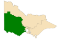 VIC Western Victoria Region 2014.png 800 × 514; 35 KB
-
 VIC Western Victoria Region 2022.svg 800 × 568; 7.3 MB
-
 Victoria State Election 2014 (Simple Map).svg 3,452 × 3,128; 386 KB
.svg)


.svg)