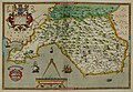
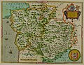
Category:Maps of Wales from Saxton’s Atlas of England and Wales
Media in category "Maps of Wales from Saxton’s Atlas of England and Wales"
The following 10 files are in this category, out of 10 total.
-
 Anglesey Caernarnan Atlas.jpg 8,849 × 6,588; 20.04 MB
-
 Anglesey Caernarnan Atlas.tif 8,849 × 6,588; 96.9 MB
-
 Dinbigh flint Atlas.jpg 8,948 × 6,437; 19.62 MB
-
 Dinbigh Flint Atlas.tif 8,948 × 6,437; 97.92 MB
-
 Glamorgana Atlas.jpg 8,828 × 6,128; 18.92 MB
-
 Glamorgana Atlas.tif 8,828 × 6,128; 90.76 MB
-
 Montgomeri Merionidh Atlas.jpg 8,208 × 6,338; 18.15 MB
-
 Montgomeri Merionidh Atlas.tif 8,208 × 6,338; 90.65 MB
-
 Radnor Brecknok Cardigan Caermarden Atlas.tif 8,685 × 6,722; 104.36 MB
-
 Radnor Brecknok Cardigan Caermarden Map.jpg 8,685 × 6,722; 21.89 MB


