Category:Maps of Western Province (Kenya)
Media in category "Maps of Western Province (Kenya)"
The following 15 files are in this category, out of 15 total.
-
 Kakamega forest map.jpg 498 × 512; 56 KB
-
 KE-Busia.png 488 × 572; 8 KB
-
 KE-Webuye.png 488 × 572; 7 KB
-
 Kenya Provinces Western.png 300 × 348; 25 KB
-
 Kenya Provinces Western.svg 300 × 348; 23 KB
-
 Kenya westp.jpg 225 × 225; 8 KB
-
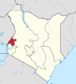
 Kenya-Western.png 488 × 572; 7 KB
-
 Province occidentale.png 455 × 699; 204 KB
-
 Rift Valley-Western location map.png 247 × 485; 8 KB
-
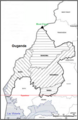
 Western Counties - bungoma.png 455 × 699; 197 KB
-
 Western counties - Busia.png 455 × 699; 200 KB
-
 Western Counties - Kakamega.png 455 × 699; 198 KB
-
 Western counties - Vihiga.png 455 × 699; 204 KB
-
 Western in Kenya (+Ilemi Triangle).svg 1,000 × 1,100; 305 KB
-
 Western in Kenya.svg 1,000 × 1,100; 304 KB


.svg)
