Category:Maps of World War II in Bretagne
Administrative regions and territorial collectivity of Metropolitan France (‡ since start of 2016):
Brittany
Brittany
Media in category "Maps of World War II in Bretagne"
The following 13 files are in this category, out of 13 total.
-
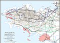
 Bretagnesas.png 1,000 × 756; 75 KB
-
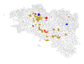 Kristian Hamon - carte actions Bezen Perrot.svg 980 × 750; 726 KB
-
-
 Plan de Rennes sous la 2nd Guerre Mondiale - Musée de Bretagne - 994.0045.31.jpg 1,500 × 1,064; 959 KB
-
 Plan des fortifications de la plage des Rosaires 01.png 2,500 × 1,342; 962 KB
-
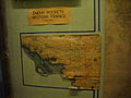
 Poche de st-Nazaire 5630.JPG 4,142 × 2,254; 1.84 MB
-
 Reims - musée de la Reddition, salle des Cartes (07).JPG 3,264 × 2,448; 3.29 MB
-
 The Chastity Plan.jpg 800 × 1,026; 182 KB
-
 US advance into Brittany.jpg 1,000 × 708; 207 KB
-
 US advance to Brest.png 742 × 516; 473 KB
-
 US Army official history map of the Battle of Saint-Malo 1944.jpg 800 × 721; 155 KB
-
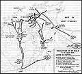
 US Army official history map of the liberation of Brittany 1944.jpg 1,200 × 865; 330 KB
-
 Бои в Ла-Манше в апреле 1944.jpg 800 × 496; 43 KB


.JPG)


