Category:Maps of Zeelandic Flanders
Subcategories
This category has the following 5 subcategories, out of 5 total.
Media in category "Maps of Zeelandic Flanders"
The following 6 files are in this category, out of 6 total.
-
 LocatieZeeuwsVlaanderen.png 270 × 130; 11 KB
-
 Map of Walcheren 1660.gif 500 × 356; 55 KB
-
 Militaire situatie in Zeeuws-Vlaanderen op 10 mei 1940.jpg 6,955 × 2,950; 5.95 MB
-
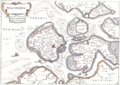
 Walcheren 1696.jpg 1,282 × 895; 173 KB
-
 Zeeuws Vlaanderen.png 140 × 73; 2 KB
-
 Zeeuwsvlaanderenmap.png 1,806 × 696; 404 KB


