Category:Maps of agriculture in Ariège
Departments of Metropolitan France: Ain [01] · Aisne [02] · Allier [03] · Alpes-de-Haute-Provence [04] · Hautes-Alpes [05] · Alpes-Maritimes [06] · Ardèche [07] · Ardennes [08] · Ariège [09] · Aube [10] · Aude [11] · Aveyron [12] · Bouches-du-Rhône [13] · Calvados [14] · Cantal [15] · Charente [16] · Charente-Maritime [17] · Cher [18] · Corrèze [19] · Corse-du-Sud [2A]† · Haute-Corse [2B]† · Côte-d’Or [21] · Côtes-d'Armor [22] · Creuse [23] · Dordogne [24] · Doubs [25] · Drôme [26] · Eure [27] · Eure-et-Loir [28] · Finistère [29] · Gard [30] · Haute-Garonne [31] · Gers [32] · Gironde [33] · Hérault [34] · Ille-et-Vilaine [35] · Indre [36] · Indre-et-Loire [37] · Isère [38] · Jura [39] · Landes [40] · Loir-et-Cher [41] · Loire [42] · Haute-Loire [43] · Loire-Atlantique [44] · Loiret [45] · Lot [46] · Lot-et-Garonne [47] · Lozère [48] · Maine-et-Loire [49] · Manche [50] · Marne [51] · Haute-Marne [52] · Mayenne [53] · Meurthe-et-Moselle [54] · Meuse [55] · Morbihan [56] · Moselle [57] · Nièvre [58] · Nord [59] · Oise [60] · Orne [61] · Pas-de-Calais [62] · Puy-de-Dôme [63] · Pyrénées-Atlantiques [64] · Hautes-Pyrénées [65] · Pyrénées-Orientales [66] · Bas-Rhin [67] · Haut-Rhin [68] · Rhône [69D]‡ · Haute-Saône [70] · Saône-et-Loire [71] · Sarthe [72] · Savoie [73] · Seine-Maritime [76] · Seine-et-Marne [77] · Yvelines [78] · Deux-Sèvres [79] · Tarn [81] · Tarn-et-Garonne [82] · Var [83] · Vaucluse [84] · Vendée [85] · Vienne [86] · Haute-Vienne [87] · Vosges [88] · Yonne [89] · Territoire de Belfort [90] · Essonne [91] · Val-de-Marne [94] · Val-d'Oise [95]
Subcategories
This category has only the following subcategory.
M
Media in category "Maps of agriculture in Ariège"
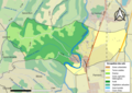
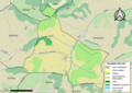
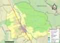
The following 43 files are in this category, out of 43 total.
-
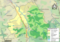 09019-Artigat-Sols.png 3,507 × 2,480; 2.44 MB
-
 09022-Arvigna-Sols.png 3,507 × 2,480; 1.46 MB
-
 09039-La Bastide-de-Bousignac-Sols.png 3,507 × 2,480; 1.48 MB
-
 09040-La Bastide-de-Lordat-Sols.png 3,507 × 2,480; 1.34 MB
-
 09060-Bonnac-Sols.png 3,507 × 2,480; 2.07 MB
-
 09061-Les Bordes-sur-Arize-Sols.png 3,507 × 2,480; 2.02 MB
-
 09067-Brie-Sols.png 3,507 × 2,480; 1.43 MB
-
 09079-Carla-Bayle-Sols.png 3,507 × 2,480; 2.98 MB
-
 09081-Le Carlaret-Sols.png 3,507 × 2,480; 2.3 MB
-
 09083-Castéras-Sols.png 3,507 × 2,480; 1.06 MB
-
 09084-Castex-Sols.png 3,507 × 2,480; 1.18 MB
-
 09089-Cazals-des-Baylès-Sols.png 3,507 × 2,480; 1.17 MB
-
 09101-Coussa-Sols.png 3,507 × 2,480; 1.22 MB
-
 09115-Esclagne-Sols.png 3,507 × 2,480; 1.21 MB
-
 09116-Escosse-Sols.png 3,507 × 2,480; 2.02 MB
-
 09124-Le Fossat-Sols.png 3,507 × 2,480; 1.83 MB
-
 09132-Gaudiès-Sols.png 3,507 × 2,480; 1.44 MB
-
 09145-Les Issards-Sols.png 3,507 × 2,480; 1.34 MB
-
 09146-Justiniac-Sols.png 3,507 × 2,480; 1.13 MB
-
 09147-Labatut-Sols.png 3,507 × 2,480; 1.46 MB
-
 09151-Lanoux-Sols.png 3,507 × 2,480; 1.03 MB
-
 09167-Lézat-sur-Lèze-Sols.png 3,507 × 2,480; 2.7 MB
-
 09175-Ludiès-Sols.png 3,507 × 2,480; 986 KB
-
 09185-Mazères-Sols.png 3,507 × 2,480; 3.31 MB
-
 09199-Montaut-Sols.png 3,507 × 2,480; 3.42 MB
-
 09213-Moulin-Neuf-Sols.png 3,507 × 2,480; 1.22 MB
-
 09225-Pamiers-Sols.png 3,507 × 2,480; 4.15 MB
-
 09238-Les Pujols-Sols.png 3,507 × 2,480; 2.17 MB
-
 09243-Régat-Sols.png 3,507 × 2,480; 1.45 MB
-
 09244-Rieucros-Sols.png 3,507 × 2,480; 1.8 MB
-
 09254-Saint-Amadou-Sols.png 3,507 × 2,480; 1.48 MB
-
 09258-Saint-Félix-de-Rieutord-Sols.png 3,507 × 2,480; 1.88 MB
-
 09275-Saint-Quirc-Sols.png 3,507 × 2,480; 1.55 MB
-
 09277-Saint-Ybars-Sols.png 3,507 × 2,480; 2.64 MB
-
 09282-Saverdun-Sols.png 3,507 × 2,480; 3.77 MB
-
 09294-Sieuras-Sols.png 3,507 × 2,480; 1.26 MB
-
 09310-Thouars-sur-Arize-Sols.png 3,507 × 2,480; 1.08 MB
-
 09312-La Tour-du-Crieu-Sols.png 3,507 × 2,480; 2 MB
-
 09315-Trémoulet-Sols.png 3,507 × 2,480; 962 KB
-
 09323-Vals-Sols.png 3,507 × 2,480; 1.36 MB
-
 09332-Verniolle-Sols.png 3,507 × 2,480; 2.46 MB
-
 09339-Villeneuve-du-Paréage-Sols.png 3,507 × 2,480; 1.42 MB
-
 09342-Sainte-Suzanne-Sols.png 3,507 × 2,480; 1.86 MB


