Category:Maps of ancient Roman aqueducts of Lugdunum
Media in category "Maps of ancient Roman aqueducts of Lugdunum"
The following 8 files are in this category, out of 8 total.
-
 Plan du barrage du Gier.png 1,270 × 1,129; 363 KB
-
 Pont de la Condamine 2.png 1,750 × 294; 189 KB
-
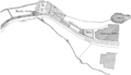
 Pont des Granges (saint-Maurice-sur-Dargoire).png 1,556 × 548; 519 KB
-
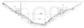
 Pont du Corsonnat.png 1,770 × 383; 242 KB
-
 Pont-aqueduc de Langonan.png 1,182 × 448; 218 KB
-
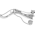
 Prise d'eau de l'Haya.png 1,430 × 823; 408 KB
-
 Viaduc de saint-Martin-la-Plaine.png 1,034 × 345; 145 KB
-
 Viaduc du Feloing.png 1,615 × 454; 278 KB


.png)