Category:Maps of caves in Austria
Countries of Europe: Austria · Belgium · Bulgaria · Croatia · Czech Republic · France‡ · Germany · Hungary · Iceland · Republic of Ireland · Italy · Montenegro · Poland · Romania · Russia‡ · Serbia · Slovenia · Spain‡ · Switzerland · United Kingdom
Limited recognition: Abkhazia‡
‡: partly located in Europe
Limited recognition: Abkhazia‡
‡: partly located in Europe
Media in category "Maps of caves in Austria"
The following 11 files are in this category, out of 11 total.
-
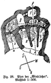 Eberhard-fugger-windloecher-plan.png 527 × 846; 349 KB
-
 Erdstall grundriss.jpg 3,019 × 2,718; 1.96 MB
-
 Gollinger Wasserfall SAT-Forschungsprojekt 2001 001.jpg 1,344 × 963; 575 KB
-
 Grasslhöhle - map.jpg 1,784 × 2,063; 817 KB
-
 Hirlatz polygon.png 972 × 729; 25 KB
-
 Hundsheimer Berg-0255.jpg 2,500 × 1,673; 2.53 MB
-
 Kammermod.jpg 3,024 × 2,200; 832 KB
-
 Kolkbläser Aufriß 1988.JPG 1,024 × 697; 92 KB
-
 Muggendorf - Myralucke, Infotafel.JPG 4,603 × 3,170; 8.37 MB
-
 Steinbruckenhoehle plan 2005.png 4,234 × 7,000; 2.63 MB
-
 Unterirdischer Gang Wildgrube 04.jpg 3,110 × 4,888; 7.56 MB


