Category:Maps of counties of Arizona
States of the United States: Alabama · Alaska · Arizona · Arkansas · California · Colorado · Connecticut · Delaware · Florida · Georgia · Hawaii · Idaho · Illinois · Indiana · Iowa · Kansas · Kentucky · Louisiana · Maine · Maryland · Massachusetts · Michigan · Minnesota · Mississippi · Missouri · Montana · Nebraska · Nevada · New Hampshire · New Jersey · New Mexico · New York · North Carolina · North Dakota · Ohio · Oklahoma · Oregon · Pennsylvania · Rhode Island · South Carolina · South Dakota · Tennessee · Texas · Utah · Vermont · Virginia · Washington · West Virginia · Wisconsin · Wyoming
- Maps of the Counties in Arizona — and the settlements−places within them.
Subcategories
This category has the following 17 subcategories, out of 17 total.
Media in category "Maps of counties of Arizona"
The following 13 files are in this category, out of 13 total.
-
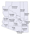 Arizona Counties en zh.png 525 × 600; 63 KB
-
 Arizona Counties.jpg 1,224 × 1,584; 247 KB
-
 Arizona County map.jpg 245 × 286; 12 KB
-
 Arizona county map.png 625 × 847; 15 KB
-
 Az county map-2.png 568 × 649; 137 KB
-
 Az county map.gif 568 × 649; 19 KB
-
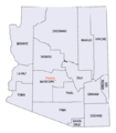
 Az county map.png 568 × 649; 15 KB
-
 Azmap.svg 5,462 × 6,331; 67 KB
-
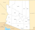
 Blank map subdivisions Arizona.svg 124 × 145; 12 KB
-
 Counties of Arizona NA (cropped).png 1,176 × 990; 98 KB
-
 Counties of Arizona NA.png 1,594 × 1,233; 240 KB
-
 DAriz.png 351 × 407; 6 KB
-
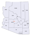
 Native american majority and plurality Arizona county map.JPG 568 × 649; 69 KB


.png)


