Category:Maps of dams in the United States
Media in category "Maps of dams in the United States"
The following 10 files are in this category, out of 10 total.
-
 Columbia dams map-fr.png 1,205 × 1,207; 465 KB
-
 Columbia dams map.png 1,205 × 1,207; 414 KB
-
 Columbia drainage basin major dams map-fr.svg 808 × 790; 3.72 MB
-
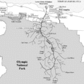 Elwha river dams.gif 500 × 503; 19 KB
-
 Kootenay dams.jpg 484 × 501; 105 KB
-
 Map of the Tennessee Valley Authority - NARA - 195895.tif 2,000 × 1,226; 2.36 MB
-
-
 Pend Oreille-Clark Fork dams.jpg 689 × 605; 151 KB
-
 Potomac Dams CoE 2-45.jpg 1,250 × 919; 131 KB
-
 Tellico Dam Map.png 3,300 × 2,550; 5.3 MB


.png)


