Category:Maps of districts of Çankırı Province
Media in category "Maps of districts of Çankırı Province"
The following 15 files are in this category, out of 15 total.
-
 Çankırı (tr).svg 924 × 624; 31 KB
-
 Çankırı districts.png 1,056 × 816; 37 KB
-
 Çankırı location districts.png 1,200 × 800; 94 KB
-
 Çankırı location Atkaracalar.png 1,200 × 800; 58 KB
-
 Çankırı location Bayramören.png 1,200 × 800; 58 KB
-
 Çankırı location Eldivan.png 1,200 × 800; 59 KB
-
 Çankırı location Ilgaz.png 1,200 × 800; 58 KB
-
 Çankırı location Kızılırmak.png 1,200 × 800; 58 KB
-
 Çankırı location Korgun.png 1,200 × 800; 58 KB
-
 Çankırı location Kurşunlu.png 1,200 × 800; 59 KB
-
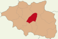
 Çankırı location Merkez.png 1,200 × 800; 59 KB
-
 Çankırı location Orta.png 1,200 × 800; 58 KB
-
 Çankırı location Yapraklı.png 1,200 × 800; 58 KB
-
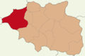 Çankırı location Çerkeş.png 1,200 × 800; 58 KB
-
 Çankırı location Şabanözü.png 1,200 × 800; 58 KB
.svg)


